Difference between revisions of "2013-11-07 39 -84"
imported>Nofu (→Participants) |
imported>Eldin m (clean up template and check categories) |
||
| Line 1: | Line 1: | ||
| − | |||
| − | |||
| − | |||
| − | |||
| − | |||
| − | |||
| − | |||
| − | |||
| − | |||
| − | |||
{{meetup graticule | {{meetup graticule | ||
| lat=39 | | lat=39 | ||
| Line 15: | Line 5: | ||
}} | }} | ||
| − | |||
__NOTOC__ | __NOTOC__ | ||
== Location == | == Location == | ||
| Line 171: | Line 160: | ||
== Achievements == | == Achievements == | ||
{{#vardefine:ribbonwidth|800px}} | {{#vardefine:ribbonwidth|800px}} | ||
| − | |||
{{land geohash | {{land geohash | ||
| latitude = 39 | | latitude = 39 | ||
| Line 187: | Line 175: | ||
}} | }} | ||
| − | |||
| − | |||
| − | |||
| − | |||
| − | |||
| − | |||
| − | |||
| − | |||
| − | |||
| − | |||
[[Category:Expeditions]] | [[Category:Expeditions]] | ||
| − | |||
[[Category:Expeditions with photos]] | [[Category:Expeditions with photos]] | ||
| − | |||
| − | |||
| − | |||
| − | |||
| − | |||
[[Category:Coordinates reached]] | [[Category:Coordinates reached]] | ||
| − | |||
| − | |||
| − | |||
| − | |||
| − | |||
| − | |||
| − | |||
| − | |||
| − | |||
| − | |||
| − | |||
| − | |||
| − | |||
| − | |||
| − | |||
| − | |||
| − | |||
| − | |||
Revision as of 22:20, 8 November 2013
| Thu 7 Nov 2013 in 39,-84: 39.1262461, -84.4667899 geohashing.info google osm bing/os kml crox |
Location
At the end of a short driveway on William Howard Taft Rd.
Participants
Plans
Plans? Plans are for the boring. And the prepared.
I'm not prepared.
Backstory
I recently rediscovered xkcd and read 1000+ comics in a weekend to get current. One of them was the infamous #426. "Cool idea," I thought. "My semester is easy. Maybe I should do this. Might even meet someone." After undergrad, during which I played Ultimate Frisbee in the rain, in the snow, in pouring sleet at 35 degrees the day after Thanksgiving (the "Hypothermia Game"), in a hurricane, and on a frozen lake, geohashing even seemed sane.
A quick look at the wiki revealed that I was well located on the border of 2 graticules - Northern Kentucky and Cincinnati - so if the hash was near the northern border of Cincinnati and out of reach, it would be near the northern border of NKY, and out the door and nary a walk down the street. Score! Problem: Without a GPS device, finding the hash, and then proving that I found the hash, would be a pain.
Despite the inability to track a hash, I kept checking the graticules to see where the hashes fell. Whether out of academic curiosity or masochism is irrelevant, because I quickly saw how rarely they fell in an accessible place.
"How far out do I have to zoom to see something besides trees?"
"I don't have a boat."
"Oh cool! In the middle of a power plant."
I decided that I wasn't missing much, and kept putting off the purchase of a GPS. Though the empty bank account also likely contributed to this procrastination.
Expedition
The morning of November 7th, 2013 dawned. I heard the sun rose in the east, again, but I was still asleep at that point, so I can only assume the rumor is true. But you know what they say about assumptions.
It wasn't until 11am - about the time that I realized I had forgotten about the 5th of November - that I checked the NKY graticule. It was centered, and near the southern border. Excited, I brought up the Cincinnati graticule, and there it was - basically downtown! I might even be able to bike. I brought up the peeron screen, switched to hybrid viewing mode to see how inaccessible it was and found that it, quite literally, was on the sidewalk of William Howard Taft Rd.
Man, I wish I had a GPS, I thought. Then I realized that the rest of my day was booked anyway; I had a shift working the circulation desk at the library until 5, then I had to go straight from there to an event at the Freedom Center, which would likely last until 9.
That's too bad. It's so close. Maybe next time.
End Scene
Me, from behind the circulation desk: "Jyoshu, you wouldn't happen to have a handheld GPS that could, potentially, show your current coordinates so you could take a picture of them?"
"Yeah."
"What are you doing later tonight?"
"The Freedom Center thing."
"After that?"
"Nothing, why?"
End Scene
I guess this is the part that I could've put in the "Plans" section. But really, I had left my apartment thinking that I wouldn't be making an attempt at the hash. I count the expedition as starting from the second I turned the key in the lock of my apartment's door. At that point, there was no turning back. Agreed? No? Too bad.
Jyoshu had not heard of geohashing. But he had heard of xkcd, so the explanation was quick and not only painless, but kind of awesome:
Me: "So, basically, it divides the world into squares, each about the size of Connecticut. And then it takes a random number - the Dow Jones opening - and forms geographical coordinates out of that number. Those coordinates are the 'hash.'"
Jyoshu: "Then you find the hash?"
Me: "Yeah."
Jyoshu: "Why?"
Me: (Shrug)
Jyoshu: "Where is today's hash?"
Me: (Holds up the laptop, showing the map that has the Cincinnati hash)
Jyoshu: "We're going, right?"
The plan expedition was formed. Because I had to be at the Freedom Center 30 minutes early so I could stand behind a table and stare at people, he would go home, grab his camera and GPS and we'd go to the hash when the event ended.
At 5pm, my shift at the circulation desk was over. I quickly packed up my things and hurried to my car to make the 5 minute drive to the Freedom Center to get there with plenty of time to park. I'd make the 5:30 deadline easy.
Little did I know that I would regret not writing down the coordinates for the hash.
Ominous music
End Scene
A full 90 minutes of me stuck in traffic in downtown Cincinnati. I pound the steering wheel. I curse. I yell. I roll down the window, curse, and yell. The profanity of my tirade knows no rules.
End Scene
"Donnie, do you have a smartphone that I could use to look something up on the internet?" I asked as we all left the Freedom Center.
"Yeah, what do you want to look up?"
Geohashing really is a pain in the ass to explain. The silence made him suspicious that I would look at porn or something, so he laughed and put his phone back in his pocket.
I waited 5 minutes, then tried again, my explanation of geohashing ready this time.
60 seconds later, we were squinting at his tiny phone, trying to read the tiny coordinates in the tiny corner of the map on the Cincinnati page. Whenever he tried zooming in on the numbers, his phone zoomed in on the map instead; then scrolling just moved the map around. He gave me the phone because my eyesight was better, and I read off what I thought were the coordinates to Jyoshu, who put them in the notepad on his cellphone.
"If you get murdered, at least we'll know where to find you," Donnie told us before splitting off to go to his car, leaving me with Jyoshu and Emily.
"Emily, where's your car?" I asked.
"I walked."
"You want a lift back?" Jyoshu asked.
"Sure."
"You want to go geohashing?" I asked.
"No."
"Pansy."
End Scene
"These coordinates don't sound right," I admitted as I climbed out of the back and into the passenger seat of Jyoshu's car. We'd just dropped Emily off at her apartment and now it was time to kick some hash.
Jyoshu plugged the coordinates that he'd put on his cellphone into his GPS. The directions included a 277 mile stint on I75 South.
"No, that's not right."
"Okay, we need internet so I can get on the wiki and find the right coordinates," I said, pulling my laptop from my backpack in the back seat and my shoulder from its socket.
"If it's on William Howard Taft Road, then we'd have to go past the law school anyway," Jyoshu pointed out. "We could stop outside the school and use the wireless signal."
He drives to the law school. We talk about how some people can't get around without internet on their phones and GPS in their cars, and how much more satisfying it is to use napkin maps and a sense of direction. I think about how this was all my idea and now Jyoshu brought all of the equipment and is the one actually doing all of the work. I feel guilty, knowing that I'm going to claim a Drag-Along Achievement, anyway.
End Scene
I tell Jyoshu to pull into a side street that I remembered being right next to the hash. He parks, we jump out. It's dark and it's cold (but above freezing), and I'm still wearing the button-up shirt and Dockers from the Freedom Center event - what some people cryptically call "casual," and which I translate to "my substitute teacher garb," but which, crucially, does not include a tie. Not for cold weather. I grab the GPS and struggle to find out how to make it show my current coordinates while shuffling back towards William Howard Taft Road to keep warm.
We both cross the street, and the numbers on the GPS close in on our target. We go up the street. Jyoshu realizes that we're reading the coordinates wrong. We come back a bit. We're 1 point off. Jyoshu is holding the GPS. He steps into the driveway of what looks like a vinyl-sided garage with a small apartment above it. There's no light on up there.
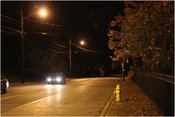
"Got it." Jyoshu said. I'm looking around for some sign that someone else was there already, but it's too dark to find anything. He takes a photo of me, holding the GPS up near my ugly mug for proof. Then he snaps one picture of the street before his camera's battery quits.
We agree to do this again, sometime.
End Scene
Credits
Achievements
Humbucker earned the Land geohash achievement
|
Humbucker earned the Drag-along achievement
|

