Difference between revisions of "2014-03-29 -43 172"
From Geohashing
imported>Quaternary |
imported>Quaternary (→Tracklog) |
||
| Line 37: | Line 37: | ||
<gallery> | <gallery> | ||
| − | Image:2014_03_29_-43_172_Geolocation. | + | Image:2014_03_29_-43_172_Geolocation.png | Arrived! |
</gallery> | </gallery> | ||
Revision as of 09:21, 29 March 2014
| Sat 29 Mar 2014 in -43,172: -43.8630715, 172.3375972 geohashing.info google osm bing/os kml crox |
Location
Taumutu, Selwyn District, Canterbury, New Zealand
Participants
The Quaternary (talk) family geohashers
Plans
A nice easy beach geohash, and on a Saturday to boot!
Expedition
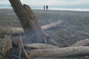
The nearest settlement to the hash is Taumutu, which means the end of a ridge, or a high ridge. At Taumutu is also found the Ngāti Moki marae.
Luckily the tide wasn't completely in, as this location might well have been underwater!
Tracklog
Photos
Achievements
Quaternary earned the Drag-along achievement
|


