Difference between revisions of "2014-08-01 66 24"
From Geohashing
imported>Isopekka (Created page with "thumb|left {{meetup graticule | lat=66 | lon=24 | date=2014-08-01 }} == Location == In Tervola, in a field. == Participants == * User...") |
imported>FippeBot m (Location) |
||
| Line 69: | Line 69: | ||
[[Category:Expeditions with photos]] | [[Category:Expeditions with photos]] | ||
[[Category:Coordinates reached]] | [[Category:Coordinates reached]] | ||
| + | {{location|FI|10}} | ||
Latest revision as of 00:53, 15 August 2019
| Fri 1 Aug 2014 in 66,24: 66.0743483, 24.7586376 geohashing.info google osm bing/os kml crox |
Contents
Location
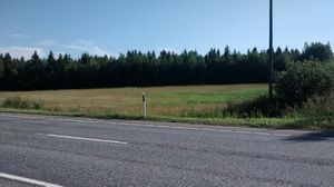
In Tervola, in a field.
Participants
Expedition
- Driving 63 km from my home, and driving further from the hash to Seskarö, Sweden
- Walking total 0.2 km
- Expedition took 0.1 h
- Physical effort (1-5): 1
Expedition started about at 8:30 a.m. The hashpoint situated quite near the highway E75, I had to walk only about 80 meters.
Photos
Achievements
isopekka earned the Land geohash achievement
|
Geohashing Expeditions and Plans on This Day
Expeditions and Plans
| 2014-08-01 | ||
|---|---|---|
| Dresden, Germany | Danatar | on a path behind the Garnisonskirche St. Martin church in Dresden-Neust... |
| Braunschweig, Germany | Danatar | in a partially harvested wheat field near Winnerstedt. Country: Germany; s... |
| Hannover, Germany | Danatar | in a maize field near Gronau (Leine). Country: Germany; state: Niedersachs... |
| Bremen, Germany | Danatar | in a hedge at Bremen-Woltmershausen. Country: Germany; state: Freie Hanses... |
| Carlisle, United Kingdom | Angel | 2.4 miles away, it's got to be worth walking out there to see if its access... |
| Tervola, Finland | isopekka | In Tervola, in a field. |


