Difference between revisions of "2014-08-17 41 -85"
imported>Mcbaneg (Created page with "<!-- If you did not specify these parameters in the template, please substitute appropriate values for IMAGE, LAT, LON, and DATE (YYYY-MM-DD format) {{{image|dummy.jpg}}}|...") |
imported>FippeBot m (Location) |
||
| Line 85: | Line 85: | ||
[[Category:Expeditions with photos]] | [[Category:Expeditions with photos]] | ||
[[Category:Coordinates reached]] | [[Category:Coordinates reached]] | ||
| + | {{location|US|IN|AL}} | ||
Latest revision as of 00:30, 7 August 2019
| Sun 17 Aug 2014 in 41,-85: 41.2306145, -85.1015844 geohashing.info google osm bing/os kml crox |
Location
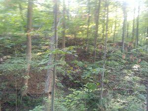
On the edge of a ravine north of Fort Wayne, Indiana, USA
Participants
Expedition
I left 2014-08-17 41 -86 and headed this way. The map showed the hashpoint between a house at the end of a dead-end road and a creek. The road leading to the house was gravel, and the driveway and parking area next to the house were under construction. However, the house looked finished and occupied. I rang the bell but no one answered. I trespassed with impunity; it's taken me over a year to get to a hashpoint in this graticule.
The creek was in a steep ravine and I was worried I might end up with a Cliffs of Despair achievement rather than progress on Minesweeper. However, the back yard had a sort of "finger mesa" that led toward the hashpoint, and I just had to go a couple of meters down the steep part toward the creek to get the nice green on-target numbers from Geohash Droid. I tried to take some pics that showed how deep and steep the creek valley was but they didn't look too impressive on the little screen, so I collected a proof-shot and moved on.
Three graticules to go for Minesweeper now!
Photos
Achievements
George earned the Multihash Achievement
|
George achieved level 5 of the Minesweeper Geohash achievement
|


