Difference between revisions of "2014-09-10 52 1"
From Geohashing
imported>Sourcerer m ([live picture] Evidence [http://www.openstreetmap.org/?lat=52.34490216&lon=1.14133358&zoom=16&layers=B000FTF @52.3449,1.1413]) |
imported>Sourcerer (→New Expedition) |
||
| Line 1: | Line 1: | ||
| − | |||
| − | |||
| − | |||
| − | |||
| − | |||
| − | |||
| − | |||
| − | |||
| − | |||
| − | |||
{{meetup graticule | {{meetup graticule | ||
| lat=52 | | lat=52 | ||
| Line 15: | Line 5: | ||
}} | }} | ||
| − | |||
__NOTOC__ | __NOTOC__ | ||
| + | |||
== Location == | == Location == | ||
| − | + | ||
| + | On Rectory Road between Brome and Brome Street south of Diss, Suffolk, UK. | ||
== Participants == | == Participants == | ||
| − | |||
| − | |||
| − | + | [[User:Sourcerer|Sourcerer]] | |
| − | |||
== Expedition == | == Expedition == | ||
| − | |||
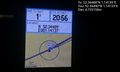
| + | *Arrived. -- [[User:Sourcerer|Sourcerer]] ([[User talk:Sourcerer|talk]]) [http://www.openstreetmap.org/?lat=52.34490752&lon=1.14132285&zoom=16&layers=B000FTF @52.3449,1.1413] 15:56, 10 September 2014 (EDT) | ||
| − | + | Setting out after dark, the drive to the hashpoint was easy, arriving at about 9pm. It must have been a good year for hedgehogs. They are rarely seen but tonight was more like a slalom course, weaving around the beasties crossing the roads. Two hares were spotted and possibly a muntjac deer with rather wonderful silvery eyes reflecting the headlights. The hashpoint was right on the road and of little interest but the journey was really nice. Heading east on the way home, an almost full, waning moon was very bright in the sky. | |
| − | |||
| − | |||
== Photos == | == Photos == | ||
| − | + | ||
| − | |||
| − | |||
<gallery perrow="5"> | <gallery perrow="5"> | ||
| − | |||
Image:2014-09-10_52_1_20-58-12-267.jpg | Evidence [http://www.openstreetmap.org/?lat=52.34490216&lon=1.14133358&zoom=16&layers=B000FTF @52.3449,1.1413] | Image:2014-09-10_52_1_20-58-12-267.jpg | Evidence [http://www.openstreetmap.org/?lat=52.34490216&lon=1.14133358&zoom=16&layers=B000FTF @52.3449,1.1413] | ||
</gallery> | </gallery> | ||
| − | |||
| − | |||
| − | |||
| − | |||
| − | |||
| − | |||
| − | |||
| − | |||
| − | |||
| − | |||
| − | |||
| − | |||
| − | |||
| − | |||
| − | |||
| − | |||
| − | |||
[[Category:Expeditions]] | [[Category:Expeditions]] | ||
| − | |||
[[Category:Expeditions with photos]] | [[Category:Expeditions with photos]] | ||
| − | |||
| − | |||
| − | |||
| − | |||
| − | |||
[[Category:Coordinates reached]] | [[Category:Coordinates reached]] | ||
| − | |||
| − | |||
| − | |||
| − | |||
| − | |||
| − | |||
| − | |||
| − | |||
| − | |||
| − | |||
| − | |||
| − | |||
| − | |||
| − | |||
| − | |||
| − | |||
| − | |||
| − | |||
Revision as of 07:27, 11 September 2014
| Wed 10 Sep 2014 in 52,1: 52.3448823, 1.1413950 geohashing.info google osm bing/os kml crox |
Location
On Rectory Road between Brome and Brome Street south of Diss, Suffolk, UK.
Participants
Expedition
- Arrived. -- Sourcerer (talk) @52.3449,1.1413 15:56, 10 September 2014 (EDT)
Setting out after dark, the drive to the hashpoint was easy, arriving at about 9pm. It must have been a good year for hedgehogs. They are rarely seen but tonight was more like a slalom course, weaving around the beasties crossing the roads. Two hares were spotted and possibly a muntjac deer with rather wonderful silvery eyes reflecting the headlights. The hashpoint was right on the road and of little interest but the journey was really nice. Heading east on the way home, an almost full, waning moon was very bright in the sky.
Photos
Evidence @52.3449,1.1413
