Difference between revisions of "2015-06-27 52 0"
imported>Sourcerer m ([retro picture] Proof. [http://www.openstreetmap.org/?lat=52.03630865&lon=.64655185&zoom=16&layers=B000FTF @52.0363,.6466]) |
imported>Sourcerer m (→New Expedition) |
||
| Line 1: | Line 1: | ||
| − | |||
| − | |||
| − | |||
| − | |||
| − | |||
| − | |||
| − | |||
| − | |||
| − | |||
| − | |||
{{meetup graticule | {{meetup graticule | ||
| lat=52 | | lat=52 | ||
| Line 14: | Line 4: | ||
| date=2015-06-27 | | date=2015-06-27 | ||
}} | }} | ||
| − | |||
| − | |||
__NOTOC__ | __NOTOC__ | ||
== Location == | == Location == | ||
| − | + | ||
| + | In a field north of Belchamp Walter, Essex, UK. | ||
== Participants == | == Participants == | ||
| − | + | ||
| − | + | [[User:Sourcerer|Sourcerer]] | |
== Plans == | == Plans == | ||
| − | + | ||
| + | This was not really planned. I realised it was not too far from [[2015-06-26 51 1]] so I took in this point on my way home. | ||
== Expedition == | == Expedition == | ||
| − | |||
| + | *Arrived. -- [[User:Sourcerer|Sourcerer]] ([[User talk:Sourcerer|talk]]) [http://www.openstreetmap.org/?lat=52.03631401&lon=.64655185&zoom=16&layers=B000FTF @52.0363,.6466] 00:01, 27 June 2015 (GMT+01:00) | ||
| − | + | It was possible to park at the village hall. A public footpath headed north but quickly faded to nothing. More stepping between sugar beet plants was needed. Then there were a few metres of oil seed rape to force my way through to zero the distance. I arrived just before midnight and had to wait in the mild breeze for the day to increment. I only ever force my way through crops if there is supposed to be a path but the farmer has not marked it. Today was a good example. | |
| − | |||
| − | |||
== Photos == | == Photos == | ||
| − | + | ||
| − | |||
| − | |||
<gallery perrow="5"> | <gallery perrow="5"> | ||
| − | |||
Image:2015-06-27_52_0_Sourcerer_1435359552403.jpg | Proof. [http://www.openstreetmap.org/?lat=52.03630865&lon=.64655185&zoom=16&layers=B000FTF @52.0363,.6466] | Image:2015-06-27_52_0_Sourcerer_1435359552403.jpg | Proof. [http://www.openstreetmap.org/?lat=52.03630865&lon=.64655185&zoom=16&layers=B000FTF @52.0363,.6466] | ||
</gallery> | </gallery> | ||
| Line 47: | Line 32: | ||
== Achievements == | == Achievements == | ||
{{#vardefine:ribbonwidth|800px}} | {{#vardefine:ribbonwidth|800px}} | ||
| − | |||
| − | + | {{Sourcerer_links | |
| − | + | | prev = 2015-06-26 51 1 | |
| − | + | | curr = 2015-06-27 52 0 | |
| + | | date = 2015-06-27 | ||
| + | }} | ||
| − | |||
| − | |||
| − | |||
| − | |||
| − | |||
| − | |||
[[Category:Expeditions]] | [[Category:Expeditions]] | ||
| − | |||
[[Category:Expeditions with photos]] | [[Category:Expeditions with photos]] | ||
| − | |||
| − | |||
| − | |||
| − | |||
| − | |||
[[Category:Coordinates reached]] | [[Category:Coordinates reached]] | ||
| − | |||
| − | |||
| − | |||
| − | |||
| − | |||
| − | |||
| − | |||
| − | |||
| − | |||
| − | |||
| − | |||
| − | |||
| − | |||
| − | |||
| − | |||
| − | |||
| − | |||
| − | |||
Revision as of 01:20, 27 June 2015
| Sat 27 Jun 2015 in 52,0: 52.0363287, 0.6466410 geohashing.info google osm bing/os kml crox |
Location
In a field north of Belchamp Walter, Essex, UK.
Participants
Plans
This was not really planned. I realised it was not too far from 2015-06-26 51 1 so I took in this point on my way home.
Expedition
- Arrived. -- Sourcerer (talk) @52.0363,.6466 00:01, 27 June 2015 (GMT+01:00)
It was possible to park at the village hall. A public footpath headed north but quickly faded to nothing. More stepping between sugar beet plants was needed. Then there were a few metres of oil seed rape to force my way through to zero the distance. I arrived just before midnight and had to wait in the mild breeze for the day to increment. I only ever force my way through crops if there is supposed to be a path but the farmer has not marked it. Today was a good example.
Photos
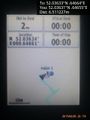
Proof. @52.0363,.6466

Achievements
Expeditions and Plans
| 2015-06-27 | ||
|---|---|---|
| Cambridge, United Kingdom | Sourcerer | In a field north of Belchamp Walter, Essex, UK. |
| Blyth, United Kingdom | Feyrob | Somewhere |
Sourcerer's Expedition Links
2015-06-26 51 1 - 2015-06-27 52 0 - LAST (until now) - KML file download of Sourcerer's expeditions for use with Google Earth.