Difference between revisions of "2016-01-30 50 11"
From Geohashing
imported>Lyx m |
imported>FippeBot m (Location) |
||
| Line 28: | Line 28: | ||
[[Category:Expeditions with photos]] | [[Category:Expeditions with photos]] | ||
[[Category:Coordinates reached]] | [[Category:Coordinates reached]] | ||
| + | {{location|DE|TH|J}} | ||
Latest revision as of 06:36, 15 August 2019
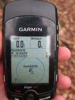
| Sat 30 Jan 2016 in 50,11: 50.9269868, 11.5378281 geohashing.info google osm bing/os kml crox |
Location
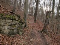
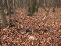
On the western edge of Jena, in the forest (Forst) near the top of Paulsberg, conveniently located on a path that Googlemaps knows but which, sadly, doesn't actually exist.
Participants
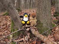
- Juja, Tux and Karl
Expedition
Another Saturday Geohash that would be too close to miss - near our regular weekend jogging route, but I preferred cycling in the morning and then my legs were tired and so I walked there. I knew the way pretty well and the forest was almost dry and pretty light and so it was no problem to reach the point, even without a path. Took the shortcut home and was back after a little more than 1h/5.5km.
Photos
|
