Difference between revisions of "2017-03-12 51 14"
From Geohashing
imported>Danatar ([live picture]Picture [http://www.openstreetmap.org/?lat=51.16495500&lon=14.93980940&zoom=16&layers=B000FTF @51.1650,14.9398]) |
imported>Danatar m |
||
| Line 1: | Line 1: | ||
| − | + | {{meetup graticule | |
| − | |||
| − | |||
| − | |||
| − | |||
| − | |||
| − | |||
| − | |||
| − | |||
| − | |||
| − | {{meetup graticule | ||
| lat=51 | | lat=51 | ||
| lon=14 | | lon=14 | ||
| date=2017-03-12 | | date=2017-03-12 | ||
| − | }} | + | | graticule_name=Cottbus |
| + | | graticule_link=Cottbus, Germany | ||
| + | }}__NOTOC__ | ||
| + | == Location == | ||
| + | |||
| + | Today's location is on a bicycle/walking track next to a country road at Girbigsdorf, near Görlitz. | ||
| − | + | Country: Germany; state: Sachsen (Saxony, EU:DE:SN); district: Görlitz | |
| − | |||
| − | + | Weather: Clouded and windy. | |
| − | |||
| − | |||
| − | |||
| − | |||
| − | == | + | == Expedition== |
| − | + | ===[[User:Danatar|Danatar]]=== | |
| − | + | ... | |
| − | |||
| Line 36: | Line 25: | ||
*Reached! -- [[User:Danatar|Danatar]] ([[User talk:Danatar|talk]]) [http://www.openstreetmap.org/?lat=51.16495290&lon=14.93980730&zoom=16&layers=B000FTF @51.1650,14.9398] 14:14, 12 March 2017 (GMT+01:00) | *Reached! -- [[User:Danatar|Danatar]] ([[User talk:Danatar|talk]]) [http://www.openstreetmap.org/?lat=51.16495290&lon=14.93980730&zoom=16&layers=B000FTF @51.1650,14.9398] 14:14, 12 March 2017 (GMT+01:00) | ||
| − | |||
| − | |||
| − | |||
| − | |||
| − | |||
| − | |||
<gallery perrow="5"> | <gallery perrow="5"> | ||
| − | |||
Image:2017-03-12_51_14_Danatar_1489324586703.jpg|Picture [http://www.openstreetmap.org/?lat=51.16495500&lon=14.93980940&zoom=16&layers=B000FTF @51.1650,14.9398] | Image:2017-03-12_51_14_Danatar_1489324586703.jpg|Picture [http://www.openstreetmap.org/?lat=51.16495500&lon=14.93980940&zoom=16&layers=B000FTF @51.1650,14.9398] | ||
</gallery> | </gallery> | ||
| − | |||
| − | |||
| − | |||
| − | |||
| − | |||
| − | |||
| − | |||
| − | + | While taking the 'revisited' picture I noticed that the white balance had been set to 'light bulb', the later photos look much better. | |
| − | + | {{gallery|width=200|height=200|lines=2 | |
| − | [[ | + | |Image:2017-03-12_51_14_zug.jpg|train from Dresden to Görlitz |
| − | -- | + | |Image:2017-03-12_51_14_ortsschild.jpg|leaving Görlitz |
| + | |Image:2017-03-12_51_14_near.jpg|almost there | ||
| + | |Image:2017-03-12_51_14_gps.jpg|GPS | ||
| + | |Image:2017-03-12_51_14_hp.jpg|Coordinates reached! | ||
| + | |Image:2017-03-12_51_14_spot.jpg|the hashpoint | ||
| + | |Image:2017-03-12_51_14_pano.jpg|panorama | ||
| + | |Image:2017-03-12_51_14_revisited.jpg|same motif as during my [[2008-09-07 51 15|very first expedition]], 8.5 years ago! | ||
| + | |Image:2017-03-12_51_14_blick-DE-PL.jpg|looking over the bridge to Poland | ||
| + | |Image:2017-03-12_51_14_neisse.jpg|the river Neiße is the border | ||
| + | |Image:2017-03-12_51_14_blick-PL-DE.jpg|looking over the bridge to Germany and to the St.-Peter-and-Paul church, 15th century | ||
| + | |Image:2017-03-12_51_14_rathaus-goerlitz.jpg|Görlitz town hall, 14th century | ||
| + | |Image:2017-03-12_51_14_dickerturm.jpg|the ''Fat Tower'', 13th century | ||
| + | }} | ||
| + | |||
| + | |||
| − | + | ===tracklog=== | |
| + | ''will follow'' | ||
| − | |||
[[Category:Expeditions]] | [[Category:Expeditions]] | ||
| − | |||
[[Category:Expeditions with photos]] | [[Category:Expeditions with photos]] | ||
| − | |||
| − | |||
| − | |||
| − | |||
| − | |||
[[Category:Coordinates reached]] | [[Category:Coordinates reached]] | ||
| − | + | [[Category:Danatar]] | |
| − | |||
| − | |||
| − | |||
| − | |||
| − | |||
| − | |||
| − | |||
| − | |||
| − | |||
| − | |||
| − | |||
| − | |||
| − | |||
| − | |||
| − | [[Category: | ||
| − | |||
| − | |||
Revision as of 09:38, 13 March 2017
| Sun 12 Mar 2017 in Cottbus: 51.1649559, 14.9398019 geohashing.info google osm bing/os kml crox |
Location
Today's location is on a bicycle/walking track next to a country road at Girbigsdorf, near Görlitz.
Country: Germany; state: Sachsen (Saxony, EU:DE:SN); district: Görlitz
Weather: Clouded and windy.
Expedition
Danatar
...
- Almost th
Almost there -- Danatar (talk) @51.1646,14.9416 14:10, 12 March 2017 (GMT+01:00)
- Reached! -- Danatar (talk) @51.1650,14.9398 14:14, 12 March 2017 (GMT+01:00)
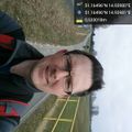
Picture @51.1650,14.9398

While taking the 'revisited' picture I noticed that the white balance had been set to 'light bulb', the later photos look much better.
|


tracklog
will follow