Difference between revisions of "2017-03-15 48 -123"
imported>Wijnland (create report) |
imported>FippeBot m (Location) |
||
| Line 57: | Line 57: | ||
[[Category:Expeditions with photos]] | [[Category:Expeditions with photos]] | ||
[[Category:Coordinates reached]] | [[Category:Coordinates reached]] | ||
| + | {{location|CA|BC}} | ||
Revision as of 02:14, 16 August 2019
| Wed 15 Mar 2017 in 48,-123: 48.4217432, -123.4441185 geohashing.info google osm bing/os kml crox |
Location
In front of Esquimalt Harbour, between Fishgard lighthouse and Brothers Islands.
Participants
Expedition
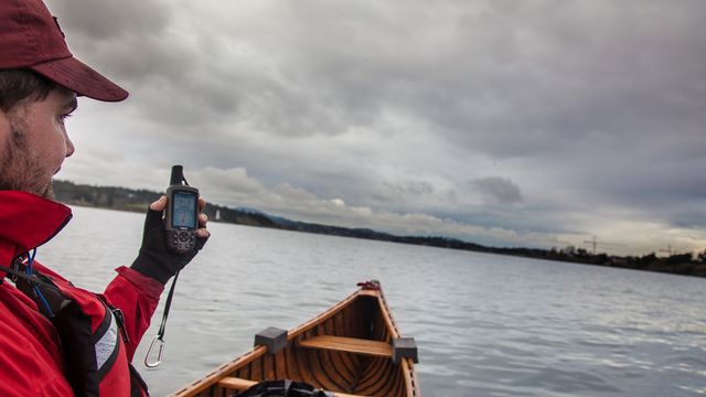
I had been lazy and did not keep track of hashes for a while, but a friend asked me about geohashing for some university course (yes, it will likely be included in some GIS classes at UBC) So I checked to find this great waterhash really close to home. I already had my canoe on me from a little paddle in the morning so decided it needed to be done. I was unable to find any drag alongs so went by myself. I launched at the little beach at the end of Foster St. in Esquimalt around 17.00 and canoed out. I reached the hash at 17.30 continued to fisgard lighthouse for some pictures and was back at my car around 18.30. There was some light rain, and very light winds. A perfectly nice paddel in the evening.
there was much widlife to see: Harbour seals, river otter, bald eagle, bunch of gulls, common mergansers, great blue heron, canada goose, other duck like things. fun was had.
Photos
Achievements
Wijnland earned the Water geohash achievement
|


