Difference between revisions of "2017-06-14 51 9"
From Geohashing
imported>GeorgDerReisende (new report) |
imported>GeorgDerReisende (expedition report for Höxter) |
||
| Line 1: | Line 1: | ||
| + | <b>This is the 300<sup>th</sup> successful expedition by me!</b> | ||
| − | |||
| − | |||
| − | |||
| − | |||
| − | |||
| − | |||
| − | |||
| − | |||
| − | |||
{{meetup graticule | {{meetup graticule | ||
| lat=51 | | lat=51 | ||
| Line 19: | Line 11: | ||
== Location == | == Location == | ||
| − | + | ||
| + | The hash lay on a meadow at the western end of Höxter. | ||
== Participants == | == Participants == | ||
| − | + | ||
| − | + | [[User:GeorgDerReisende|GeorgDerReisende]] | |
== Plans == | == Plans == | ||
| − | + | ||
| + | Hitchhiking. | ||
== Expedition == | == Expedition == | ||
| − | |||
| − | + | I left home at 10 o'clock. I started to hitchhike at 11:15. With three cars I arrived at Höxter. I walked to the hash. Straight way. Easy. | |
| − | + | ||
| + | I didn't want to travel the same way back and with seven cars and a detour to Seesen I arrived at home at 20:10. | ||
== Photos == | == Photos == | ||
| − | |||
| − | |||
| − | |||
<gallery perrow="5"> | <gallery perrow="5"> | ||
| + | Image:2017-06-14 51 9 GeorgDerReisende 6724.jpg | hash ahead! | ||
| + | Image:2017-06-14 51 9 GeorgDerReisende 6726.jpg | 45 meters to hash | ||
| + | Image:2017-06-14 51 9 GeorgDerReisende 6727.jpg | no need to dance | ||
| + | Image:2017-06-14 51 9 GeorgDerReisende 6728.jpg | proof | ||
| + | Image:2017-06-14 51 9 GeorgDerReisende 6729.jpg | the north | ||
| + | Image:2017-06-14 51 9 GeorgDerReisende 6730.jpg | the east | ||
| + | Image:2017-06-14 51 9 GeorgDerReisende 6731.jpg | the south | ||
| + | Image:2017-06-14 51 9 GeorgDerReisende 6732.jpg | the west | ||
| + | Image:2017-06-14 51 9 GeorgDerReisende 6733.jpg | the geohasher | ||
</gallery> | </gallery> | ||
| Line 45: | Line 45: | ||
<!-- Add any achievement ribbons you earned below, or remove this section --> | <!-- Add any achievement ribbons you earned below, or remove this section --> | ||
| − | + | {{Easy_geohash | latitude = 51 | longitude = 9 | date = 2017-06-14 | name = GeorgDerReisende }} | |
| − | |||
| − | |||
| − | + | {{Thumbs Up | latitude = 51 | longitude = 9 | date = 2017-06-14 | name = GeorgDerReisende }} | |
| − | + | [[Category:Expeditions]] | |
| − | |||
| − | [[Category: | ||
| − | |||
| − | + | [[Category:Expeditions with photos]] | |
| − | |||
| − | |||
| − | |||
| − | |||
| − | |||
| − | |||
| − | |||
| − | |||
| − | |||
[[Category:Coordinates reached]] | [[Category:Coordinates reached]] | ||
| − | |||
| − | |||
| − | |||
| − | |||
| − | |||
| − | |||
| − | |||
| − | |||
| − | |||
| − | |||
| − | |||
| − | |||
| − | |||
| − | |||
| − | |||
| − | |||
| − | |||
| − | |||
Revision as of 18:42, 14 June 2017
This is the 300th successful expedition by me!
| Wed 14 Jun 2017 in 51,9: 51.7783125, 9.3706785 geohashing.info google osm bing/os kml crox |
Location
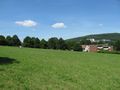
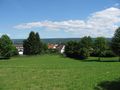
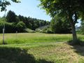
The hash lay on a meadow at the western end of Höxter.
Participants
Plans
Hitchhiking.
Expedition
I left home at 10 o'clock. I started to hitchhike at 11:15. With three cars I arrived at Höxter. I walked to the hash. Straight way. Easy.
I didn't want to travel the same way back and with seven cars and a detour to Seesen I arrived at home at 20:10.
Photos
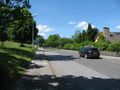
hash ahead!
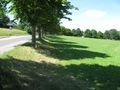
45 meters to hash
no need to dance
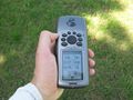
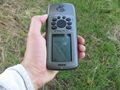
proof
the north
the east
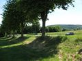
the south
the west
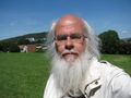
the geohasher


Achievements
GeorgDerReisende has visited an Easy Geohash
|
GeorgDerReisende earned the Thumbs Up Geohash Achievement
|