Difference between revisions of "2018-04-09 48 7"
From Geohashing
imported>Timm m (Categories) |
imported>Timm |
||
| Line 22: | Line 22: | ||
== Participants == | == Participants == | ||
| − | *[[User:Timm|Timm]] | + | *[[User:Timm|Timm]] and his sister |
== Plans == | == Plans == | ||
| − | *[[User:Timm|Timm]]: I'll try to be there around 4:00 pm, but I'm currently staying very close by, so I can come whenever. Just let me know if you want to meet up. | + | *[[User:Timm|Timm]]: I'll try to be there around 4:00 pm, but I'm currently staying very close by, so I can come whenever. Just let me know if you want to meet up. Update: because no one else wrote, I got there a little earlier. |
| + | == Expedition == | ||
| + | There isn't much to tell, because this was an easy one for me. I had to run some errands in a nearby town anyway, so I just got out of the car near the hash, took a few pictures and left. My sister came with to the hash, so I guess this counts as a [[Drag-along]]. | ||
| + | The hashpoint itself was on a field, but we could walk there safely between the planted rows without trampling anything. | ||
| + | == Photos == | ||
| + | <gallery perrow="5"> | ||
| + | Image:2018-04-09-48_7-0.jpg|A huge solar array we passed (about 1km long) | ||
| + | Image:2018-04-09-48_7-1.jpg|The road near the hash | ||
| + | Image:2018-04-09-48_7-2.jpg|Proof | ||
| + | Image:2018-04-09-48_7-4.jpg|My sister at the hashpoint | ||
| + | |||
| + | Image:2018-04-09-48_7-3.jpg|Me at the hashpoint | ||
| + | </gallery> | ||
| + | |||
| + | == Achievements == | ||
| + | {{drag-along | ||
| + | | latitude = 48 | ||
| + | | longitude = 7 | ||
| + | | date = 2018-04-09 | ||
| + | | name = Timm | ||
| + | }} | ||
| + | {{Two to the N achievement | ||
| + | | count = 1 | ||
| + | | latitude = 48 | ||
| + | | longitude = 7 | ||
| + | | date = 2018-04-09 | ||
| + | | reached = true | ||
| + | | name = Timm | ||
| + | }} | ||
| + | {{land geohash | ||
| + | | latitude = 48 | ||
| + | | longitude = 7 | ||
| + | | date = 2018-04-09 | ||
| + | | name = Timm | ||
| + | }} | ||
| + | |||
| + | |||
| + | |||
| + | |||
| + | [[Category:Expeditions]] | ||
| + | [[Category:Expeditions with photos]] | ||
| + | [[Category:Coordinates reached]] | ||
| Line 43: | Line 84: | ||
<!-- Potential categories. Please include all the ones appropriate to your expedition --> | <!-- Potential categories. Please include all the ones appropriate to your expedition --> | ||
<!-- If this is a planning page: | <!-- If this is a planning page: | ||
| + | [[Category:Expedition planning]] | ||
--> | --> | ||
| − | |||
<!-- If all those plans are never acted upon, change [[Category:Expedition planning]] to [[Category:Not reached - Did not attempt]]. --> | <!-- If all those plans are never acted upon, change [[Category:Expedition planning]] to [[Category:Not reached - Did not attempt]]. --> | ||
<!-- An actual expedition: | <!-- An actual expedition: | ||
| − | |||
-- and one or more of -- | -- and one or more of -- | ||
[[Category:Expeditions with photos]] | [[Category:Expeditions with photos]] | ||
Revision as of 09:48, 11 April 2018
| Mon 9 Apr 2018 in 48,7: 48.0440903, 7.6357555 geohashing.info google osm bing/os kml crox |
Location
On a field near Ihringen.
Participants
- Timm and his sister
Plans
- Timm: I'll try to be there around 4:00 pm, but I'm currently staying very close by, so I can come whenever. Just let me know if you want to meet up. Update: because no one else wrote, I got there a little earlier.
Expedition
There isn't much to tell, because this was an easy one for me. I had to run some errands in a nearby town anyway, so I just got out of the car near the hash, took a few pictures and left. My sister came with to the hash, so I guess this counts as a Drag-along.
The hashpoint itself was on a field, but we could walk there safely between the planted rows without trampling anything.
Photos
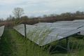
A huge solar array we passed (about 1km long)
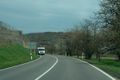
The road near the hash
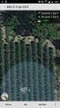
Proof

My sister at the hashpoint

Me at the hashpoint


Achievements
Timm earned the Drag-along achievement
|

Timm earned the Two to the N achievement
by reaching 21 hashpoints on 2018-04-09 48 7 and is promoted to Level 1 (Coordinates reached).
Timm earned the Land geohash achievement
|