Difference between revisions of "2018-10-08 51 9"
imported>GeorgDerReisende (wrong data in template) |
imported>FippeBot m (Location) |
||
| Line 56: | Line 56: | ||
[[Category:Expeditions with photos]] | [[Category:Expeditions with photos]] | ||
[[Category:Coordinates reached]] | [[Category:Coordinates reached]] | ||
| + | {{location|DE|HE|KS}} | ||
Latest revision as of 04:10, 16 August 2019
| Mon 8 Oct 2018 in 51,9: 51.3033076, 9.2802727 geohashing.info google osm bing/os kml crox |
Location
In a forest north of Martinhagen
Participants
Plans
Since I had taken a day off, I decided to go for today's hash, combining it with two geoaching-tours in the same area.
Expedition
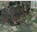
I left home 8:30 am and arrived in Martinhagen around 9:30 am, parked my car at the Martinsweiher (a nice little park at the edge of the village) and started my walk to find some geocaches. After some 50 minutes, I made a left turn to visit the geohash - some 400 meters up north. There was an excellent road, leading me almost directly to the hash, which was located in some beautiful nature. The final 25 meters I had to get off the path, to reach the hash at some 2 meters accuracy - a very nice and quaint place in the forest...
Took some pics and continued my geocaching tour and did another hike after that. I got back home 14:30 pm, enjoyed a beer and celebrated the 15 kilometers I had walked today...
Tracklog
Photos
Achievements
Digiphono earned the Two to the N achievement
|


