Difference between revisions of "2008-06-18 49 -123"
imported>Thepiguy (Categories added) |
imported>Robyn (Added Easy ribbon) |
||
| Line 23: | Line 23: | ||
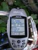
Image:2008-06-18 49 -123 gps.jpg|Geohash achieved! | Image:2008-06-18 49 -123 gps.jpg|Geohash achieved! | ||
</gallery> | </gallery> | ||
| + | |||
| + | {{Easy_geohash | latitude = 49 | longitude = -123 | date = 2008-06-18 | name = Thepiguy | image = 2008-08-09 49 -123 me.jpg }} | ||
[[Category:Expeditions]] | [[Category:Expeditions]] | ||
[[Category:Expeditions with photos]] | [[Category:Expeditions with photos]] | ||
[[Category:Coordinates reached]] | [[Category:Coordinates reached]] | ||
Revision as of 06:54, 12 August 2008
| Wed 18 Jun 2008 in 49,-123: 49.2239913, -123.1639119 geohashing.info google osm bing/os kml crox |
On the side of SW marine drive. How easy is that?
Details
thepiguy first reached the site at ~7:45 on his way to work, without even knowing it!
It wasn't until I got to work and checked the map that I realized I had already been there. I stopped again on the way home to take some pictures. No body else was there, unless you count the 80ish people that drove by while I was standing there. I got honked at once, but I think that was just because the hash was on a blind corner, and they almost hit me.
According to google, the location was on the other side of the very large hedge, in the driveway of a very large and expensive house. My location on the side of the road was within 1" of both latitude and longitude thought, more than close enough for me!

Stupidly grinning me
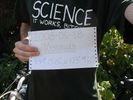
The sign and the shirt
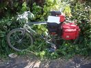
Bicycle Geohash!
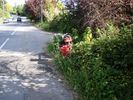
Yay for "scenery!"
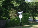
Nearby street corner
Geohash achieved!


Thepiguy has visited an Easy Geohash
|