Difference between revisions of "2019-10-23 54 13"
(Created page with "__NOTOC__ {{meetup graticule | lat=54 | lon=13 | date=2019-10-23 | graticule_name = Greifswald, Deutschland | graticule_link=54,13 }} == Location == Between two fi...") |
(→Achievements: Dark Ages achievement) |
||
| Line 63: | Line 63: | ||
{{land geohash | latitude = 54 | longitude = 13 | date = 2019-10-23 | name = SastRe.O | image = 2019-10-23 54 13 hash.JPG}} | {{land geohash | latitude = 54 | longitude = 13 | date = 2019-10-23 | name = SastRe.O | image = 2019-10-23 54 13 hash.JPG}} | ||
{{bicycle geohash | latitude = 54 | longitude = 13 | date = 2019-10-23 | name = SastRe.O with Winterbuche | distance = 35km | bothways = true}} | {{bicycle geohash | latitude = 54 | longitude = 13 | date = 2019-10-23 | name = SastRe.O with Winterbuche | distance = 35km | bothways = true}} | ||
| + | {{Dark Ages | latitude = 54 | longitude = 13 | date = 2019-10-23 | name = SastRe.O}} | ||
== Other Geohashing Expeditions and Plans on This Day == | == Other Geohashing Expeditions and Plans on This Day == | ||
Revision as of 18:06, 31 March 2020
| Wed 23 Oct 2019 in Greifswald, Deutschland: 54.0363825, 13.2411958 geohashing.info google osm bing/os kml crox |
Location
Between two fields in the edge of Dersekow, MV, Germany.
Participants
Plans
To go there in the afternoon, right after lunch. Go back before the sun sets.
Expedition
Again a near geohash from Greifswald. Not near enough to walk there, though. So I had to grab my bike Winterbuche. The problem was, however, that I had to repair the rear wheel before that.
I took of at 16:00, and first I tried to pump the wheel and see how far it would resist. A couple of hundred meters later, waiting at the traffic light, I noticed that it wouldn't work. So I searched for a quite place and made a quick change of tubes, which I was prepared for. About... 15 minutes later I was ready to go again.
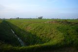
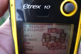
Then it was a normal expedition. I approached the hash from the south, once I was close from there. The hash fell right between two fields, in the canal that separates them, which also is the limit of the municipality of Dersekow.
Once there, I saw on the other side of the field a group of 3 deer. I had my binoculars with me. After that I biked back home through a slightly different way.
I went for a geocache and after that after some palindromic coordinates. Then I was ready to finish the expedition.
Tracklog
Photos
|
Achievements
SastRe.O earned the Land geohash achievement
|
SastRe.O with Winterbuche earned the Bicycle geohash achievement
|
SastRe.O earned the Dark Ages achievement
|
Other Geohashing Expeditions and Plans on This Day
Expeditions and Plans
| 2019-10-23 | ||
|---|---|---|
| Frankfurt am Main, Germany | GeorgDerReisende | The hash lay in front of the house Adolf-Todt-Straße 20 in Wiesbaden-Biebri... |
| Stralsund, Germany | SastRe.O | Between two fields in the edge of Dersekow, MV, Germany. |

