Difference between revisions of "2010-10-11 50 -120"
imported>FippeBot m (Location) |
m (More specific location) |
||
| Line 46: | Line 46: | ||
[[Category:Expeditions with photos]] | [[Category:Expeditions with photos]] | ||
[[Category:Coordinates reached]] | [[Category:Coordinates reached]] | ||
| − | {{location|CA|BC}} | + | {{location|CA|BC|TN}} |
Latest revision as of 23:34, 9 August 2020
| Mon 11 Oct 2010 in 50,-120: 50.7245464, -120.2820229 geohashing.info google osm bing/os kml crox |
Location
Just off Paul Lake Road, north of Kamloops
Participants
- Rhonda
- Rhonda's mom
- Wump
- Xore
Expedition
This is an attempted reconstruction of an expedition based on photographic evidence discovered nearly 3 years later.
Photos
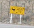
On the drive, we were warned of big horn sheep,
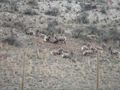
and there were indeed big horn sheep to be seen!
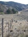
This is the terrain close to the road.
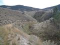
This is the terrain farther from the road.
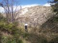
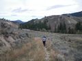
Hiking toward the hash. This is obviously before reaching the hashpoint because as everybody knows, it's always uphill to the geohash.
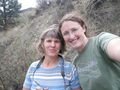
The adventurers, Rhonda and Rhonda's mom,
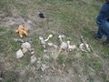
clearly made it to the hashpoint as a stone marker commemorating the event was built. Wump's presence at the marker suggests that Xore was also present.
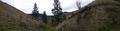
This panorama must be the area around the hashpoint.
Then everybody walked back toward the road. Which, logically, must be downhill, because it's always uphill to the geohash. Right?


Achievements
- Land Geohash