Difference between revisions of "2021-12-26 53 10"
m (→Photos) |
(→Photos) |
||
| Line 48: | Line 48: | ||
Image:2021-12-26_53_10_125657.JPG | … but it takes me there. | Image:2021-12-26_53_10_125657.JPG | … but it takes me there. | ||
Image:2021-12-26_53_10_132850.JPG | After the hashing, I drive on to the center of Hitzacker, to where we used to ride our motorcycles for an ice cream at the café in the background in the glory days. | Image:2021-12-26_53_10_132850.JPG | After the hashing, I drive on to the center of Hitzacker, to where we used to ride our motorcycles for an ice cream at the café in the background in the glory days. | ||
| − | Image: | + | Image:Inked133726_LI.JPG | The “glory days” refer here to the time before motorcycles were banned from the (in-)famous ''Elbuferstraße'' (Elbe bank road?). |
Image:2021-12-26_53_10_134940.JPG | At the ''Elbuferstraße'', there is a hill called ''Kniepenberg'' with an observation tower on the top… | Image:2021-12-26_53_10_134940.JPG | At the ''Elbuferstraße'', there is a hill called ''Kniepenberg'' with an observation tower on the top… | ||
Image:2021-12-26_53_10_135220.JPG | … that provided a stunning view over the Elbe river. | Image:2021-12-26_53_10_135220.JPG | … that provided a stunning view over the Elbe river. | ||
Revision as of 16:30, 29 December 2021
| Sun 26 Dec 2021 in 53,10: 53.1075265, 10.7059686 geohashing.info google osm bing/os kml crox |
Location
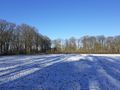
On a snow-covered field near Himbergen.
Participants
Plans
Expedition
Tracklog
Photos
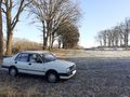
Easy parking by the side of the road for the Papamobil. I follow the path in the background towards the geohash.

Having walked about 100 meters from the road (the car is parked at the bend), it's still about 200 meters to go.
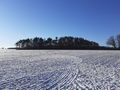
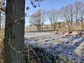
On this field it should be, just in front of the small forest.

Here we are.
I put (temporarily) the plastic bag with my mask on the spot.
This is not the direction I came from, but it may be a shortcut to the car.
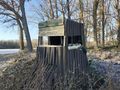
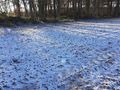
I pass by this thingy, which is the lowest high seat I have ever seen, really minimalistic.
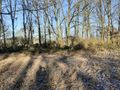
The “shortcut” to the car turns out to be a bit cumbersome…
… but it takes me there.
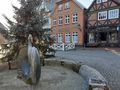
After the hashing, I drive on to the center of Hitzacker, to where we used to ride our motorcycles for an ice cream at the café in the background in the glory days.
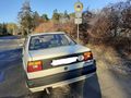
The “glory days” refer here to the time before motorcycles were banned from the (in-)famous Elbuferstraße (Elbe bank road?).
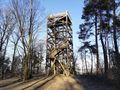
At the Elbuferstraße, there is a hill called Kniepenberg with an observation tower on the top…
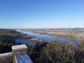
… that provided a stunning view over the Elbe river.


