Difference between revisions of "2008-05-30 1 103"
imported>FippeBot m (Location) |
m (Replacing Peeron with Geohashing.info) |
||
| Line 12: | Line 12: | ||
Jurong Industrial Estate in Singapore, across the AYE from [[wikipedia:Jurong BirdPark|Jurong BirdPark]]. To be precise, the spot is inside Caterpillar Asia Pte Ltd at 7 Tractor Road, off Jln Boon Lay / Jln Ahmad Ibrahim. Reachable by bus 194, 249, 251 or 252 from Boon Lay Interchange, plus a short walk. | Jurong Industrial Estate in Singapore, across the AYE from [[wikipedia:Jurong BirdPark|Jurong BirdPark]]. To be precise, the spot is inside Caterpillar Asia Pte Ltd at 7 Tractor Road, off Jln Boon Lay / Jln Ahmad Ibrahim. Reachable by bus 194, 249, 251 or 252 from Boon Lay Interchange, plus a short walk. | ||
| − | This marks the first "accessible" geohash on land in Singapore since the algorithm was published in xkcd comic #426, and the first geohashing expedition in Singapore. (The | + | This marks the first "accessible" geohash on land in Singapore since the algorithm was published in xkcd comic #426, and the first geohashing expedition in Singapore. (The {{egl|2008-05-23|1,103|text=coordinates for 2008-05-23}} were on land, but inside a military training area so access was restricted.) |
==Expeditions== | ==Expeditions== | ||
Revision as of 20:31, 15 January 2022
| Fri 30 May 2008 in 1,103: 1.3227205, 103.7045834 geohashing.info google osm bing/os kml crox |
About
1.3227205387098275, 103.7045834347042035
Jurong Industrial Estate in Singapore, across the AYE from Jurong BirdPark. To be precise, the spot is inside Caterpillar Asia Pte Ltd at 7 Tractor Road, off Jln Boon Lay / Jln Ahmad Ibrahim. Reachable by bus 194, 249, 251 or 252 from Boon Lay Interchange, plus a short walk.
This marks the first "accessible" geohash on land in Singapore since the algorithm was published in xkcd comic #426, and the first geohashing expedition in Singapore. (The coordinates for 2008-05-23 were on land, but inside a military training area so access was restricted.)
Expeditions
r0d3n7z
Expedition route on Google Maps
Don't have GPS, but was able to get within about 15-20 meters (50-65 feet) (loc) of the exact point using aerial photograph from Google Maps.
Reached the area by public transport at around 16:50 local time. Scouted out the Caterpillar Asia compound, found double-gated security at the main entrance, conspicuous warning signs, and lots of security cameras. Unable to gain access, I flanked south and made my way to the park connector (loc) (actually just a simple bicycle/running track) that runs along the west side of the compound, got there at around 17:00.
The southwest corner of the compound fence was reachable by climbing a short slope, it is adjacent to a small electrical substation (loc) on AYE / Jln Ahmad Ibrahim. Judging from Google Maps, the exact point is inside the southwest corner of the building.
After stumbling across a dead bird, I found a way to walk along the south side of the fence, which I thought would get me closer to the point. (I was wrong, just discovered I'd misread the aerial photography when rechecking the map online.) Left a mark (in the wrong place!) by propping a dead branch against the fence and placing a flower (loc) -- ought to attract the attention of any observant person poking around the place, the flower came from a tree (loc) 20 meters away.
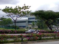
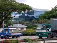
At this point (17:15), I started getting attacked by mosquitoes and decided to beat a hasty retreat. Crossed the expressway by means of overhead bridge (loc), snapped a couple more pictures from across the road showing the Caterpillar building and electrical substation. Took a short rest at Jurong BirdPark, helped some tourists who needed directions, then hopped onto bus 194 (loc) back to Boon Lay.
- Pictures
This electrical substation is visible on google maps at 1.32235, 103.7045.


