Difference between revisions of "2022-09-09 52 -0"
PeterRoder (talk | contribs) |
m (Location) |
||
| Line 52: | Line 52: | ||
[[Category:Coordinates reached]] | [[Category:Coordinates reached]] | ||
| + | {{location|GB|ENG|MIK}} | ||
Revision as of 18:42, 10 September 2022
| Fri 9 Sep 2022 in 52,-0: 52.0481390, -0.7423466 geohashing.info google osm bing/os kml crox |
Location
Campbell Park, Milton Keynes
Participants
Expedition
After leaving home at about 10:00, the start of the route was my walk to school from over a decade ago, so was quite nostalgic. The rest of the route was also familiar, but I still made a slight navigational error, crossing the H5 too early. Fortunately, this had very little effect on the length of my journey, and I reached the general vicinity of the hash at about 10:50.
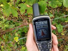
The hash itself was just on the other side of a barbed wire fence, but I was well within the gps circle of uncertainty just by leaning over the fence, so I did not feel the need to climb it.
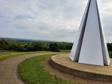
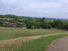
I then walked up a hill and took photos of a couple of sculptures in the park (red cross marks the approximate hash location).
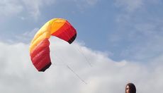
I had also brought a kite with me, hoping to fly it, but photographing this by myself was rather challenging. The only place I could be in the wind and in view of the hash was next to the light pyramid. I left my tablet leaning against the light pyramid videoing me, but as this was only a few meters away from the edge of the hill, I couldn't fit the kite a full length in frame. Instead, I flew it on a couple of meters of string to get the picture, then did some proper kite flying afterwards.
I set off at about 11:10. The return journey was uneventful, and I took the correct route this time, bringing me home at 12:00.
Tracklog
Achievements
Peter earned the Fly a kite achievement
|


