Difference between revisions of "2020-12-30 52 9"
m (user categories) |
m (Adding hours) |
||
| Line 44: | Line 44: | ||
[[Category:Expeditions with photos]] | [[Category:Expeditions with photos]] | ||
{{location|DE|NI|H}} | {{location|DE|NI|H}} | ||
| − | {{user categories|user=Fippe|bike=22}} | + | {{user categories|user=Fippe|bike=22|hours=08}} |
Latest revision as of 19:33, 11 December 2022
| Wed 30 Dec 2020 in Hannover: 52.4099999, 9.7969270 geohashing.info google osm bing/os kml crox |
Location
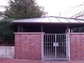
This Geohash is located next to a house on Ludwig-Sievers-Ring in Hannover.
Participants
Expedition
I took the bicycle to Bothfeld in the morning. As I was riding the moon was setting and it got lighter outside. Most of my way went along the Midland Canal, eventually I left it though and went toward Ludwig-Sievers-Ring. I located the coordinates next to one of the houses and recorded proof.
It was time for the sun to rise, but I could not see it due to the high houses blocking the horizon. I returned the same way I came. Along the Midland Canal, I could see the sun rising.
Photos
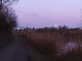
The setting moon
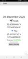
Proof
The Geohash
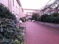
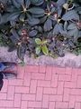
Surroundings
Surroundings
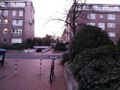
Surroundings
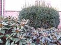
Surroundings
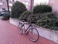
My bicycle at the coordinates
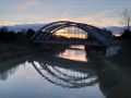
A bridge in front of the rising sun
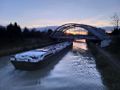
A ship passing under the bridge
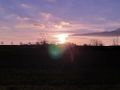
The rising sun


Achievements
Fippe earned the Sunrise Geohash Achievement
|
Fippe earned the Bicycle geohash achievement
|
Fippe earned the Land geohash achievement
|