Difference between revisions of "2022-12-13 52 8"
From Geohashing
(expedition report for Bad Oeynhausen) |
m (Location) |
||
| Line 43: | Line 43: | ||
[[Category:Coordinates reached]] | [[Category:Coordinates reached]] | ||
| + | {{location|DE|NW|MI}} | ||
Latest revision as of 14:42, 8 January 2023
| Tue 13 Dec 2022 in 52,8: 52.1929087, 8.7992036 geohashing.info google osm bing/os kml crox |
Location
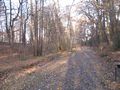
The hash lay in the valley of the Hambkebach in Bad Oeynhausen.
Participants
Plans
Traveling to Bad Oeynhausen, walking to the hash, then walking around Bad Oeynhausen.
Expedition
I traveled by train to Bad Oeynhausen, walked to the hash and afterwards I made a walk around Bad Oeynhausen.
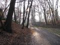
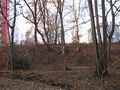
Photos
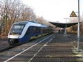
arrived at Bad Oeynhausen
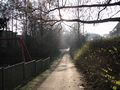
the entrance to the valley
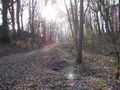
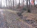
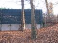
the hash area
the geohash

proof
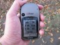
proof
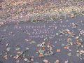
I wrote a note there
looking north
east
south
west

the geohasher


