Difference between revisions of "2023-02-21 51 8"
From Geohashing
(expedition report for Stromberg) |
m (Location) |
||
| Line 42: | Line 42: | ||
[[Category:Coordinates reached]] | [[Category:Coordinates reached]] | ||
| + | {{location|DE|NW|WAF}} | ||
Latest revision as of 11:45, 1 March 2023
| Tue 21 Feb 2023 in 51,8: 51.8047892, 8.1809096 geohashing.info google osm bing/os kml crox |
Location
The hash lay at the entrance of the Limberger Weg in Oelde-Stromberg.
Participants
Plans
Traveling to Stromberg and walking from there to Oelde and passing the hash.
Expedition
Traveled to Stromberg, walked to the hash, and walked to Oelde.
Photos
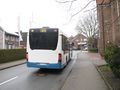
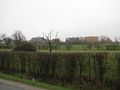
arrived in Stromberg
first view

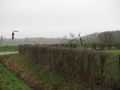
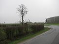
Limberger Weg, the hash lay near the bench

proof
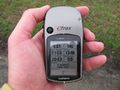
proof
looking north
east
south
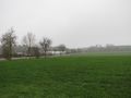
west

the geohasher
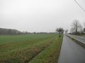
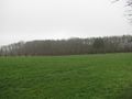
the hash area


