Difference between revisions of "2024-09-19 -38 143"
m (Location) |
(→Expedition) |
||
| Line 20: | Line 20: | ||
I alit at Winchelsea, and it definitely did not feel like -4.7, but it was definitely very windy. I headed northwards, with the wind alternating between being more of a crosswind and more of a headwind as the road turned one way and the other. The farmland was mostly cropped rather than grazing land, (bad for geohashing), and I entertained myself trying to identify the crops. There was canola, broadbeans and some kind of oniony thing. The road was also very quiet so another branch of entertainment was counting how few vehicles I came across. In the 18km of road up to the highway, the number of vehicles that passed me I could count on the fingers of one hand... and toes of two feet. That's right there were 15 of them. Less than one per kilometre. | I alit at Winchelsea, and it definitely did not feel like -4.7, but it was definitely very windy. I headed northwards, with the wind alternating between being more of a crosswind and more of a headwind as the road turned one way and the other. The farmland was mostly cropped rather than grazing land, (bad for geohashing), and I entertained myself trying to identify the crops. There was canola, broadbeans and some kind of oniony thing. The road was also very quiet so another branch of entertainment was counting how few vehicles I came across. In the 18km of road up to the highway, the number of vehicles that passed me I could count on the fingers of one hand... and toes of two feet. That's right there were 15 of them. Less than one per kilometre. | ||
| − | I saw animals, however, across the whole trip: horses horsing around (rolling on their backs like nutters), sheep, cows, corellas, galahs, magpies, ravens, a yellow-rumped thornbill, a white-faced heron, straw-necked ibis, wattle birds, skylarks, rabbits, wood ducks, chestnut teals. | + | I saw animals, however, across the whole trip: horses horsing around (rolling on their backs like nutters), sheep, cows, pigs, corellas, galahs, magpies, ravens, a yellow-rumped thornbill, a white-faced heron, straw-necked ibis, wattle birds, skylarks, rabbits, wood ducks, chestnut teals, dusky moorhens. |
Once I reached the highway, as foreseen, the headwind was terrible. I could barely ride in a straight line, there was no paved shoulder, and the traffic was definitely present and travelling at speed. At least the traffic wasn't too dense, I could generally get a couple of hundred metres or so, constantly checking over my shoulder, before spotting something coming up behind me, and which point my self-preservation instinct compelled me to divert into the gravel on the side of the road, until the road was clear again, and I could get another few hundred metres up the road. | Once I reached the highway, as foreseen, the headwind was terrible. I could barely ride in a straight line, there was no paved shoulder, and the traffic was definitely present and travelling at speed. At least the traffic wasn't too dense, I could generally get a couple of hundred metres or so, constantly checking over my shoulder, before spotting something coming up behind me, and which point my self-preservation instinct compelled me to divert into the gravel on the side of the road, until the road was clear again, and I could get another few hundred metres up the road. | ||
| Line 41: | Line 41: | ||
Such a pity that the nice N-set's days servicing Warrnambool and now extremely numbered. If I want to geohash on an N-set again, it might have to be to the Swan Hill graticule... | Such a pity that the nice N-set's days servicing Warrnambool and now extremely numbered. If I want to geohash on an N-set again, it might have to be to the Swan Hill graticule... | ||
| − | |||
== Photos == | == Photos == | ||
Revision as of 01:42, 20 September 2024
| Thu 19 Sep 2024 in -38,143: -38.0845834, 143.9511244 geohashing.info google osm bing/os kml crox |
Location
In a small strip of bush on the edge of the Hamilton Highway
Participants
Plans
Train to Winchelsea, ride up a back road to the highway, tick off Colac graticule and complete Minesweeper Achievement for Melbourne West, then back to a train.
Expedition
Having knocked off the Ballarat, St Arnaud and Bendigo graticules this year, I had just Colac to go for the Minesweeper. As such I had been diligently checking these hashes for accessibility and attainibility. There tended to be issues with both. There's a lot of farmland that I didn't particularly want to trespass on, and even when the points lay on public land, the possibility of getting there by train and bike could be difficult (deep in forest, hours from the closest station etc.)
But then there was today's hash: On the road reservation, about 20km north of Winchelsea (this graticule's closest train station to Melbourne) and what's more, trains were running again on this line, after having been replaced by coaches for an extended period. I had to go for it. The main problem was the road was the Hamilton Highway - fairly busy and not particularly bike friendly. Oh well, the road up from Winchelsea looked quiet, and then it was only about three kays up the highway to the hash.
I looked at the train timetable, and saw that I would have to do the 44km to the hash and back in just over two hours to make the next train - quite an ask especially when you consider faff at the hash - otherwise it would be a few more hours until the train after. To avoid such a wait, I might have to ride back into Geelong from the hash, all the way along the highway, making it more like 60km in total. I was optimistic and booked my train with this early return from Winchelsea (knowing that there'd be no problems if I ended up on a later train. I was also hoping that the professed lack of spots for bikes on my outbound train, according to the V/Line website, was not going to cause issues).
I got to the station just after 10, and thankfully, there were no issues boarding - the conductor was very happy to accommodate my bicycle in the luggage compartment. It was nice not having to bother stopping at any of the stops between Footscray and Geelong, and once we were past Geelong, the cafe-bar opened and I could get a cup of tea and a muffin. I checked the BOM app at one stage for weather updates, and was startled to discover that though the current temperature in Winchelsea was around 10, the "feels like" temperature was -4.7! This seemed to be because of a westerly wind blowing at 70kph, and gusting higher. This did not bode well for my few kays heading west up the Hamilton Highway, but on the other hand it made riding east all the way back to Geelong much more appealing.
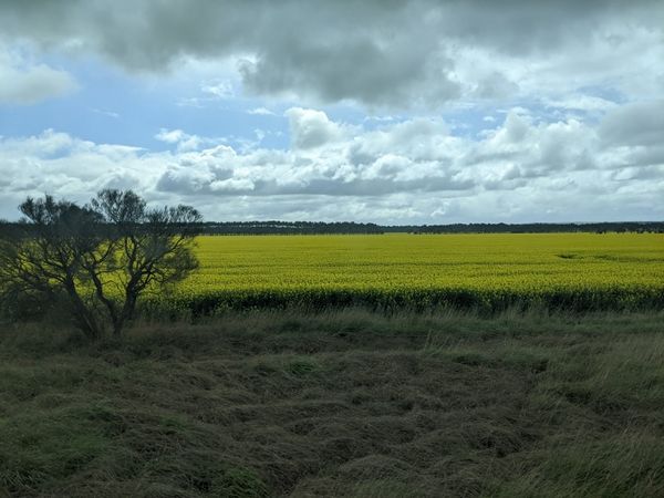
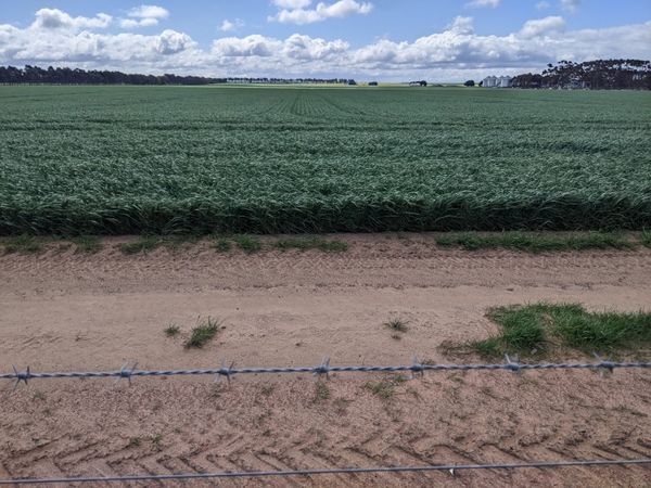
I alit at Winchelsea, and it definitely did not feel like -4.7, but it was definitely very windy. I headed northwards, with the wind alternating between being more of a crosswind and more of a headwind as the road turned one way and the other. The farmland was mostly cropped rather than grazing land, (bad for geohashing), and I entertained myself trying to identify the crops. There was canola, broadbeans and some kind of oniony thing. The road was also very quiet so another branch of entertainment was counting how few vehicles I came across. In the 18km of road up to the highway, the number of vehicles that passed me I could count on the fingers of one hand... and toes of two feet. That's right there were 15 of them. Less than one per kilometre.
I saw animals, however, across the whole trip: horses horsing around (rolling on their backs like nutters), sheep, cows, pigs, corellas, galahs, magpies, ravens, a yellow-rumped thornbill, a white-faced heron, straw-necked ibis, wattle birds, skylarks, rabbits, wood ducks, chestnut teals, dusky moorhens.
Once I reached the highway, as foreseen, the headwind was terrible. I could barely ride in a straight line, there was no paved shoulder, and the traffic was definitely present and travelling at speed. At least the traffic wasn't too dense, I could generally get a couple of hundred metres or so, constantly checking over my shoulder, before spotting something coming up behind me, and which point my self-preservation instinct compelled me to divert into the gravel on the side of the road, until the road was clear again, and I could get another few hundred metres up the road.
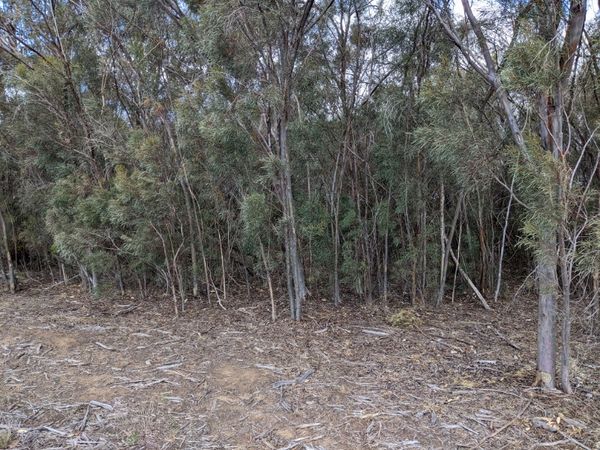
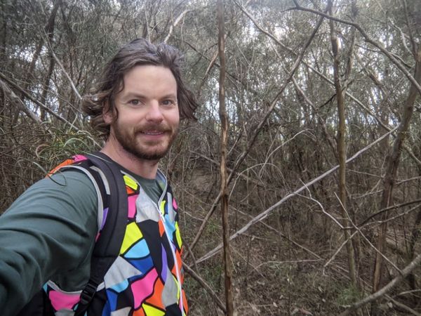
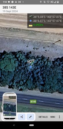
Very unsustainable, but thankfully it needn't be sustained. I only had to go 3ks. And then I was there. I left the road, and but continued along the road reservation on the other side of a thin strip of bush. The reason for the generously wide road reservation became clear, there was a power line running along this side of the bush. Many thanks to this power line, for making the road reservation wide enough to accommodate the hashpoint. To reach the point, itself, I had to duck into the bush for a second, but thankfully, it wasn't too thick, and the GPS behaved itself in there. I got my pic and my screenshot, had an apple and considered my options.
I only had 45mins to ride the 22km back to Winchelsea for my booked train. Even with more tailwind than not, it would be mostly crosswind to head back south, and it did not seem possible. 37km to Geelong it was then, with a tailwind up the highway. Riding with the tailwind was much nicer than when it was a headwind. It makes the traffic much more bearable too. Even though cars and trucks still passed with similar frequency, at least I had got about three times further in the meantime than I had before. Also with a tailwind, I was much more confident maintaining a predictable straight line and not wobbling out into a vehicle's path.
The wind was so strong that I was comfortably able to maintain speeds of 40kph on the flat. Only once before in my life, as a teenager, had I ridden with such a tailwind, and I had been beginning to wonder if the idea of cruising along at 40 on the flat was my memory playing tricks on me, but here I was, it was happening again, proving such a thing to be possible. There was one decent into a valley where I even pushed into the mid 60s. At this speed my bike did start to not feel quite so sturdy. My watch buzzed and told me my last 5k had taken 6:15, an average speed of 48kph and I decided I might hold back slightly from this point on.
Still the kays flew by. A brief but heavy shower passed over very conveniently just as I was passing through Inverleigh, where there was a veranda waiting to shelter me for a few minutes. I was back on my way, and before I knew it I was on the outskirts of Geelong. A sign directed cyclists along a river path which looked appealing so I took it. It was delightful, until I had to leave the valley and found myself staring at a vertical wall. My subsequent research tells me the Queens Park Road climb is 529m at an average grade of 9.8%. I seriously doubted I would make it to the top while still mounted, but I somehow managed. Luckily, after reaching the top I found "Munchies on Aphrasia", a shop that sold me a potato cake, a spinach and feta triangle, and a passionfruit drink.
I headed down to Geelong station, and as I was approaching I heard a train horn. Maybe it'll be perfect timing to get a train home. It turned out my timing was miraculously perfect. It was, in fact, the very train that I had booked on. It was about 15 minutes late, and my tailwind had been so good that I had managed to catch it, even with my snack stop.
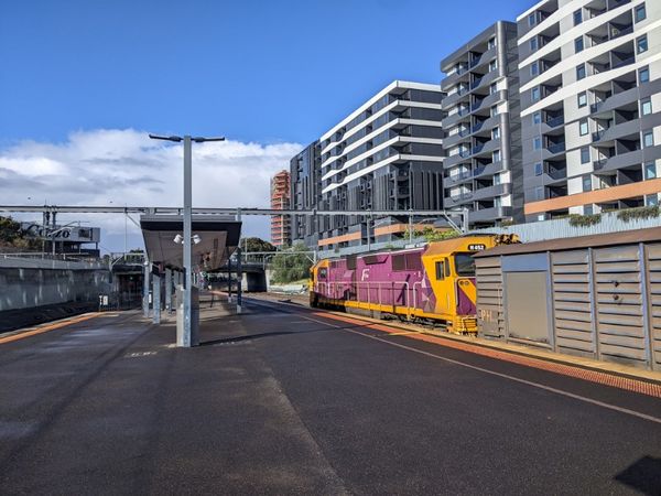
This was excellent news, because, being a train coming in from Warrnambool, it was a much nicer loco-hauled N-set compared to the rest of the trains that service Geelong. . And once again, being a Warrnambool service, it didn't need to stop at any other stations. It was a Geelong to Footscray express - perfect!
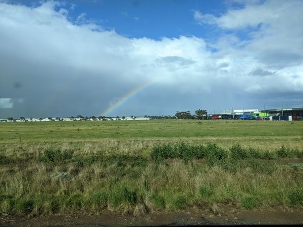
On the ride in, there was an excellent rainbow that also stuck around for a long time. Very pleasant window-staring conditions.
I got back to Footscray, and rode home triumphantly.
Such a pity that the nice N-set's days servicing Warrnambool and now extremely numbered. If I want to geohash on an N-set again, it might have to be to the Swan Hill graticule...
Photos
Achievements
John completed the Minesweeper Geohash achievement
|
