Difference between revisions of "2024-09-12 53 10"
From Geohashing
m (Location) |
|||
| Line 1: | Line 1: | ||
{{meetup graticule|date=2024-09-12|lat=53|lon=10}} | {{meetup graticule|date=2024-09-12|lat=53|lon=10}} | ||
== Location == | == Location == | ||
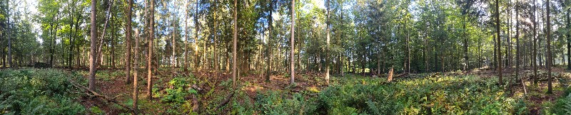
| − | + | in ''Endern'' forest in Kisdorf, Schleswig-Holstein | |
== Participants == | == Participants == | ||
| − | *[[User:π π π|π π π]] | + | * [[User:π π π|π π π]] ([[User talk:π π π|talk]]) |
| − | |||
| − | |||
| − | |||
== Expedition == | == Expedition == | ||
| − | + | to follow | |
| − | |||
| − | |||
| − | |||
== Photos == | == Photos == | ||
| − | < | + | <gallery mode="packed" heights="150px"> |
| − | |||
| − | |||
| − | |||
| − | |||
Image:2024-09-12_53_10_π π π_1726127932185.jpg|Endern's Game | Image:2024-09-12_53_10_π π π_1726127932185.jpg|Endern's Game | ||
| − | |||
Image:2024-09-12_53_10_π π π_1726127963999.jpg|getting chilly | Image:2024-09-12_53_10_π π π_1726127963999.jpg|getting chilly | ||
| − | |||
Image:2024-09-12_53_10_π π π_1726127997034.jpg|Eagle has landed | Image:2024-09-12_53_10_π π π_1726127997034.jpg|Eagle has landed | ||
| − | |||
Image:2024-09-12_53_10_π π π_1726128063407.jpg|p-roof [https://openstreetmap.org/?mlat=53.80172840&mlon=10.06359770&zoom=16 @53.8017,10.0636] | Image:2024-09-12_53_10_π π π_1726128063407.jpg|p-roof [https://openstreetmap.org/?mlat=53.80172840&mlon=10.06359770&zoom=16 @53.8017,10.0636] | ||
| − | |||
Image:2024-09-12_53_10_π π π_1726128097092.jpg|Closeup | Image:2024-09-12_53_10_π π π_1726128097092.jpg|Closeup | ||
</gallery> | </gallery> | ||
== Achievements == | == Achievements == | ||
| − | + | Land geohash, Public transport geohash | |
| − | |||
__NOTOC__ | __NOTOC__ | ||
| Line 40: | Line 25: | ||
[[Category:Expeditions with photos]] | [[Category:Expeditions with photos]] | ||
[[Category:Coordinates reached]] | [[Category:Coordinates reached]] | ||
| + | [[Category:Land geohash achievement]] | ||
| + | [[Category:Public transport geohash achievement]] | ||
{{location|DE|SH|SE}} | {{location|DE|SH|SE}} | ||
Latest revision as of 11:04, 29 September 2024
| Thu 12 Sep 2024 in 53,10: 53.8024901, 10.0635769 geohashing.info google osm bing/os kml crox |
Location
in Endern forest in Kisdorf, Schleswig-Holstein
Participants
Expedition
to follow
Photos
Endern's Game

getting chilly

Eagle has landed

p-roof @53.8017,10.0636

Closeup


Achievements
Land geohash, Public transport geohash