Difference between revisions of "2008-07-26 52 5"
From Geohashing
imported>Thomcat (Success/failure category added) |
imported>Jevanyn (Though this page doesn't really prove what elevation/depth he was at....) |
||
| Line 26: | Line 26: | ||
Image:horsepet.JPG|A bunch of horses stood quite near the coordinates. | Image:horsepet.JPG|A bunch of horses stood quite near the coordinates. | ||
</gallery> | </gallery> | ||
| + | |||
| + | {{Low Geohash | latitude = 52 | longitude = 5 | date = 2008-07-26 | name = Azijn | depth = -16' (-5 m) }} | ||
[[Category:Expeditions]] | [[Category:Expeditions]] | ||
[[Category:Expeditions with photos]] | [[Category:Expeditions with photos]] | ||
[[Category:Coordinates reached]] | [[Category:Coordinates reached]] | ||
Revision as of 01:47, 12 January 2009
| Sat 26 Jul 2008 in 52,5: 52.3492491, 5.3190500 geohashing.info google osm bing/os kml crox |
WookieTrash' first Geohash took him meters off the paved road on a warm summer day. He's still recovering from the strain. As far as he knows, no one else showed up.
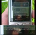
He was wrong! Azijn & Friends showed up (a little late at 16:11), and petted the horses and enjoyed the quiet. They then proceeded to find some geocaches nearby!
WookieTrash is now a bit embarrassed for leaving so soon, and will wait a little longer next time.
Photos
Azijn earned the Lowest Geohash Achievement
|


