Difference between revisions of "2008-08-03 51 11"
imported>Paintedhell |
imported>FippeBot m (Location) |
||
| Line 35: | Line 35: | ||
[[Category:Expeditions with photos]] | [[Category:Expeditions with photos]] | ||
[[Category:Coordinates reached]] | [[Category:Coordinates reached]] | ||
| + | {{location|DE|ST|BLK}} | ||
Revision as of 06:16, 7 August 2019
| Sun 3 Aug 2008 in 51,11: 51.1075008, 11.6815970 geohashing.info google osm bing/os kml crox |
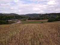
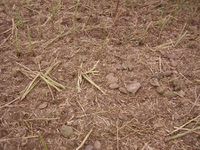
I started by bike from Jena, taking my friend Basti with me, and we wanted to see some sights on our way to the hash, so we didn't take the direct way but walked through forests and over hills to see the castle ruins of Kunitz (Kunitzburg), the castles of Dornburg and Camburg. The weather was fine and it was all very nice, but behind Camburg we got lost somehow. On the satellite picture, the hash looked like a nice greenish field, so I had hoped to find a field of corn - but all we got were some dry stubbles and lots of dirt. Even cabbage would have been better. When we finally found the field, our mood wasn't too good and all we thought was "What?! This is it?!"
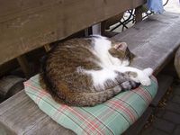
Anyway, we went back to Kleinheringen and had some cake there - and found a kitty, so the world was nice again. And on our way back to Camburg we stopped to go swimming there - so it has been a nice afternoon, after all. And another graticule is no virgin any more.
---Paintedhell
- Photo Gallery
Now it really is a kitty!
Awards
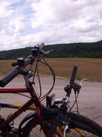
Juja earned the Bicycle geohash achievement
|


