2009-03-01 52 12
| Sun 1 Mar 2009 in 52,12: 52.3552815, 12.9206630 geohashing.info google osm bing/os kml crox |
Participants
Plans
Looking for a nice weekend hash, we discovered this place in our neighbor graticule, which caught our eyes mostly because it was on an intersection in a village, and there seemed to be some nice lakes close by. When we checked the maps (we have actual paper maps of this area) this morning, we discovered a Brickworks Museum close by and the decision was set. lyx phoned up two of our friends and neighbors who enthusiastically accompanied us on the expedition.
Expedition
It was one of the first warm and sunny days, witnessing of the spring time that is about to come. We met with Antje and Andreas at the bus station and headed off to main station. From there, a regional train would take us to Werder, from whence it is a mere 6km walk to todays hash point. We kept Andreas in the dark about that last little point. With the sun blazing from the sky, they even put on some sunscreen.
After a short and undescript train passage, we reached the little town of Werder upon Havel, which is best known for its fruit production, mostly of apples and cherries, and an annual binge drinking party disguised as cherry blossom time festival.
We set out happily chatting and saw a bakery selling yesterday's produce, a nice old gate of an engineering company (nice as in having that Eastern Bloc charme), and generally had a jolly good time. There were knotty old trees in the towns forest, which had a not entirely spectacular sight on the lakes. We learned later that the hill on which the forest grows, just as many other in the area, are overburden residues from the industrial extraction of clay. Down the stairs again, we passed some of the cherry trees(?) the town is famous for (while the rest of the roads looked more like this).
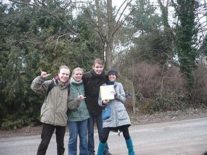
But soon enough, there were signs pointing out the brickworks museum, and eventually we reached the crossing next to the hash itself. Oh joy, we did not even need to resort to a GPS device as the satellite and cartographic survey was unambiguous. The hash lies in the middle of a single lane road.
Right next, I would like to add, to the Glindow Brickworks Museum, along with a historic brickworks, which is still active producing bricks and decorative elements out of clay for the reconstruction and maintenance of historic buildings [http://relet.net/g2/d/14236-2/P1030417.JPG (or sometimes less historic ones). The museum itself is just that tower, though. There was a sign indicating the opening hours (12am-4pm) and times (beginning on March 1. Yay for pure chance!). The front door was locked, though. So we circled the tower once, peering through the windows and sat down on a nearby bench for a picnic.
Tracklog
None. It was no batteries this time.
Photos
inline.
