2009-10-25 48 8
| Sun 25 Oct 2009 in 48,8: 48.7392029, 8.5315647 geohashing.info google osm bing/os kml crox |
Contents
Location
In a forest south of Bad Wildbad
Participants
Plans
Bad Wildbad can be reached by light rail (S6) from Pforzheim and Karlsruhe. One can use the Sommerbergbahn on the way from the station to the hash, making it the first (afaik) expedition using a funicular as mode of transportation. Koepfel talk 20:57, 23 October 2009 (UTC)
- Do you have any plans about when to go there? I'm actually considering doing this because of the funicular. Might try to combine it with some other destinations during the day. --Ekorren 17:43, 24 October 2009 (UTC)
Inspired by Sermoa's webcam hash yesterday, I decided to try the same on this expedition. I found two webcams in Bad Wildbad that I might pass by during the expedition.
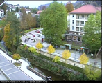
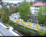
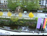
One is located at the Kurplatz, a person holding a larger sign might be recognizable. [1]
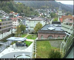
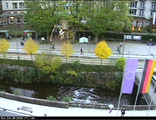
The other one is located at upper station of the funicular at the Sommerberg. This one can be controlled by the user, however, it seems only be able to film the valley and not the actual station. If you pan to the very left, you can see a small platform, that seems to be accessible to the public. I'll try to get there. [2]
When I'm near one of them, I might alert IRC (via iphone).
Report
Karlsruhe - Bad Wildbad - Sommerberg
I started at home at 13:00, took the S2 and S4 to Karlsruhe-Durlach, from where I took the 13:23 Regionalexpress to Pforzheim. In Pforzheim, I changed into the S6 to Bad Wildbad.
Until a few years ago, the Enztalbahn (Enz Valley Railway, Enz being the river going through the valley) terminated at Bad Wildbad station, just outside the actual town. However, when the Karlsruhe light rail took over the line in 2002, they extended it about one kilometer into the town, as a tram. I got off at the stop Bad Wildbad Uhlandplatz, which is about 20 meters from the Sommerbergbahn, the funicular climbing up to the Sommerberg,
The next car was leaving in 4 minutes, so, among several others, who just got out of the light rail, I went into the funicular station and bought a ticket (t Euro). Unfortunately, the funicular was incredibly crowded, I got the last available standing place and didn't really get to take any photos in the lower station or inside the car.
I got out at the upper station. Several of the passengers were downhill bikers, who used the funicular to get back up the hill.
I tried to find webcam number 2, which I spotted attatched to the corner of the station building. I contacted Myka and Sermoa via IRC, but due to the impossible controls of the camera, they weren't able to pan it over to me. Luckily, we had another camera in Bad Wildbad, so I decided to locate the hashpoint now.
Sommerberg - Hash - Bad Wildbad
The walk towards the hash was not that interesting, there was slight rain and a few downhill biking tracks I had to cross. Eventually, I realized, that even though I thought I had to walk another 2 kilometers (around the mountain, on a less steep path), the GPS pointed 90° into the forest, with only 300 meters to go. Roads are overrated, I thought, 300 meters was below my stupidity distance, so I went for it. It was a rather steep decline from now on, but after only slipping once, I managed to find the hashpoint.
Find it more or less. Due to the fact, that the area around the hashpoint was covered with tall trees with lots of leaves, the GPS signal strenght was rather low. In the end, I just picked one random rock as the hashpoint, wrote a marker and placed it there. If the hashpoint was somewhere else, I walked over it during my GPS-dance. Due to the low light and also the steep terrain, I didn't take too many non-blurry photos.
The path I actually planned to arrive on was only a few meters below the hashpoint. At about 16:00, I left, but not before scratching "XKCD" into the path, but it didn't come out too well.
I had two possible algorithms for my way back down: Google Maps' algorithm or "Always take the path with the steeper decline". Google Maps, not knowing 80% of the paths, suggested a larger walk through the mountains, which basicially used the car road near the funicular to get down. Estimated time (walking): 1 hour. The second algorithm works better, in the end, I arrived in Bad Wildbad at 16:25.
After crossing another (or the same) downhill biking track and walking downhill myself, I arrived in Bad Wildbad. There, I contacted Myka and Sermoa on IRC. The problem: the camera changed it's angle every 15 miutes and I didn't know where to stand.
Results of the geohashcam
Well ... it sort of worked! MykaDragonBlue and Sermoa were watching the Kurplatz camera for about an hour before Koepfel arrived so we figured out that it switches between 5 different views and stays on each for about 15 minutes. Having seen all 5 views we got a pretty good mental map of the area so that we were able to direct Koepfel around via irc.
Panorama
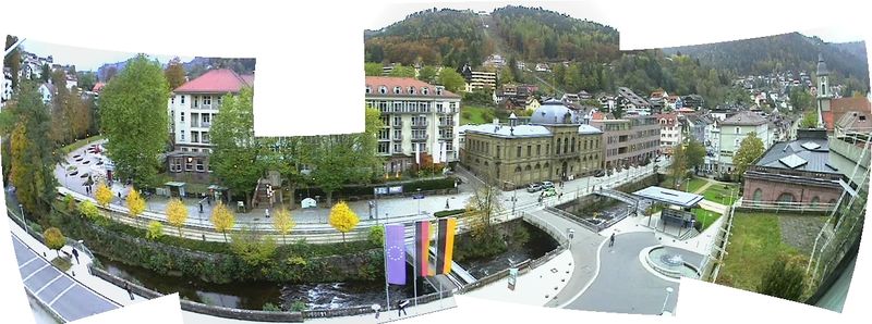
Here is a panorama that i created by stitching together the 5 views offered to us:
Koepfel is seen in front of the flags holding up a sign. And also somewhere else! 100 points to the first person to spot the other Koepfel!
Animated video
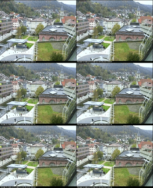
This sequence shows Koepfel by the fountain, trying to hold up a sign for us to read, but there was no chance we could see what it says. If only Koepfel could have got up on that grassy roof, haha! We started trying to remote control Koepfel through the irc channel:
- 16:39 - koepfel please make your body in to an X
- 16:46 - photograph that pink hoodie person!
- 16:47 - tell them the internet says hi!
- 16:51 - you could play The Lying Down Game
Geohashcam gallery
I didn't manage to get the body-shape letters very well. Some i thought i'd got but my screenshot must have been delayed. Maybe MykaDragonBlue managed to get them better. Here are some reasonably good shots:
The Way back Home
After we were done taking webcam pictures, I walked around in Bad Wildbad, took a few more photos, even though it was getting dark, bought and ate some food while waiting for my train back home.
Eventually, a delayed S6 arrived. I got on, the train left at 17:36 and arrived about 1 hour and 20 minutes later at Karlsruhe Durlacher Tor. Every 2 hours, a S6 changes into a S5 in Pforzheim and runs through into the Karlsruhe Inner city. The one I took on the way there did the same, however, I took the express train then, since the light rail serves every stop on the way to Pforzheim, so you actually save 15 minutes by taking the express train (and changing trains two more times). From Durlacher Tor I took a S2 home, arriving at 19:15
