2010-09-10 41 2
| Fri 10 Sep 2010 in 41,2: 41.8520529, 2.5179132 geohashing.info google osm bing/os kml crox |
Location
- Near Sant Hilari, or rather the C-25, Catalonia, Spain
Participants
- relet 17:07, 10 September 2010 (UTC)
Plans
Drive by that geohash, see how accessible it is, and then on to Olot.
Expedition
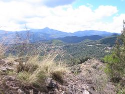
I navigated the mess that is Barcelona (only traffic-wise) quite quickly, and was soon on the road to Vic. From there in direction of Saint Hillary, along small roads, and parked in the proximity of the hash. The arrow pointed towards the brushy hills, and the number said 800m.
I had spent the whole time thinking about where I could have left the USB car charger for my phone. Suddenly, I realized, that I had left stuff in two of my drawers in the hotel room back in Barcelona. Hence the change of plans to head back to BCN for the evening - travelling without t-shirts is no fun.
Being optimistic that fresh clothes would await there, I headed into the thick brush on a steep hill on a sunny day in Spain. I followed something like a track for about 100m, and was greeted by frantic dog barking somewhere uphills, and a thick wall of brush. What a great expedition.
I headed back, and decided to drive a little further in the direction of Sant Hilari, since the mountains looked nice. Surprisingly, the arrow of the GPS eventually found a place even closer to the geohash. I was at about 450m, where some offroad tracks headed in direction of the hills. I decided to park and try my luck another time.
I followed one of the tracks until I reached a 210m. It curved again and led to the closed gate of a fenced vineyard. I went a bit back, to where it said 205m, and inspected the underbrush and overgrowth and the brambles in general. After having scrambled through the brambles for some fifteen minutes again, I decided to call it quits again.
A little further back up the hill I saw another opening in the brushes. It let to the top of a small canyon, at the bottom of which I was able to see another track. I scrambled down. It led me to about 180m, and then farther away again. To the hashside of the path stood a solid wall of sandy loose earth. I decided to call it quits again.
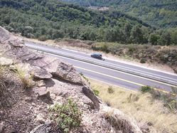
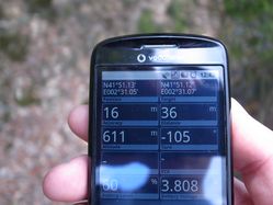
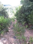
A little further back up the hill, I found a side track. Since it was a track, and did not involve scrambling, I decided to follow it for a bit, even if it pointed in the other direction. It curved eventually, and led a bit closer. I remembered that trick at the next crossing and chose not the path that lay in the direction of the hash. And lo and behold, I could hear the highway coming closer and closer. The track curved back a few times, but it eventually led me as close as 36m. Which is where it ended at a steep cliff that led down to the highway, where I overheard that some people were working.
The arrow pointed to the side though, and so I left my backpack near the side of the road and went off into the bushes again.
Tracklog
I do have a tracklog this time! Let's see where I can save it.
Photos
|
