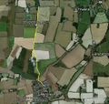
2012-03-12 52 1
From Geohashing
Revision as of 20:40, 12 March 2012 by imported>Sourcerer
| Mon 12 Mar 2012 in 52,1: 52.2660062, 1.0786461 geohashing.info google osm bing/os kml crox |
Location
On a public footpath near Mendlesham 12km south of Diss, Norfolk, UK. Logged at Wikiloc.
Participants
Expedition
- Arrived. -- Sourcerer @52.2660,1.0787 17:40, 12 March 2012 (GMT)
This was a very easy expedition involving a three mile walk and a short drive to reach the area. The hashpoint was just off a public footpath. As this footpath was missing from OpenStreetMap, I have added it.
Tracklog
Logged at Wikiloc.
Photos
Achievements
Sourcerer earned the OpenStreetMap achievement
|


