2008-09-27 51 14
| Sat 27 Sep 2008 in 51,14: 51.9185578, 14.3839487 geohashing.info google osm bing/os kml crox |
| Sat 27 Sep 2008 in 51,13: 51.9185578, 13.3839487 geohashing.info google osm bing/os kml crox |
Participants
- Relet
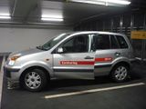
- Carlos the Carsharing Car.
Expedition
Ok, now that my hand is slightly better, I will try to catch up with a few of the stories I promised.
With a bit of time to spare in the evening, I decided to go for a ride to the Cottbus and Dresden graticules. I believed them both to be virgin graticules, and they were missing in my mission towards the Brandenburg regional achievement. Due to the spontaneous nature of the decision, I decided to take Carlos, the carsharing car with me. Carsharing is great, and I can only recommend any city planner to go for public transport, carsharing and higher driving and parking tolls (in exactly that order, not the reverse). It makes a city so much more livable.
I booked the car from 8pm to 2am on Sunday, rode by bike to the station and off we went. We drove down highway 113 towards Cottbus first, up to Lübben exit, then by regional roads. By the time it was dark, and there was a slight fog in every valley we passed. It's mostly the kind of hills and valleys which Arvid mentioned somewhere, which you don't notice unless for example the fog collects inside (or, as he put it, you suddenly go faster or slower by bike without noticing a slope).
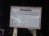
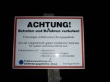
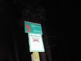
The OpenStreetMap showed the area to be in the forest, with a few tracks going in the general direction. When I turned into the track, I was greeted by a big sign. I basically stated that this was a former military area where dangers may lurk in the form of ammunition shells and in the general area of bunkers and buildings. The area was divided into three zones: Yellow for access granted at your own risk. Blue for access forbidden. And red for also access forbidden, with a few extra warnings. The track consisted of concrete slabs, and since there was no sign declaring it as a forest road, I assumed that it was ok to continue driving.
I followed the road for a while, then turned into another track. Eventually, I reached another sandier track leading into the forest and parked Carlos to continue on foot. The sandy track also continued in the opposite direction, facing which I actually discovered one of the blue zone signs, the only one I ever saw in the area. I started towards the hash in what I assumed to be yellow zone, by lack of signs.
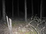
The road was sandy, and some trees were cut down at about waist height on both sides. I navigated by the backlight of my GPS, which by now I much prefer to an actual flashlight. A bright flashlight allows you to see much where you point it at, but once your eyes are adjusted to a dimmer, diffuse light, you can actually see the surroundings. The hash location turned out to actually be right on a track.
I celebrated the first successful mission to this graticule with a glass of cherries which I brought to that purpose. Fresh cherries where nowhere to be found at that time of year, obviously. I then headed back towards Carlos, and we went on to drive to the second hash near Dahme, in the Dresden graticule. I was "lucky" to drive down a few roads which were still missing on the OpenStreetMap on this occasion, meaning I could add to the project.
The track leading to the hash was a forest track this time, which means I had to park Carlos with still quite a distance to go. Furthermore, midnight was approaching, which would invalidate the hash. I therefore had to hurry up - as good as it gets, on a forest track at night. I was very lucky to discover the hash very close to another perpendicular forest track. I just had to take a few steps into the forest to actually get within the 10m GPS tolerance margin. Time check - only three minutes to go. I basically spent these minutes to get a proper screenshot of the actually very jumpy readings. Possibly, the tolerance was again much higher today. Note that it was no midnight hash, as it was the end of the day and east of 30W.
I again celebrated with cherries, unknowing that there probably has been another expedition in this graticule dating to the days of old, when no claims and no proofs were known to hashkind.
I originally had planned, if time allowed, to continue my journey towards the Sunday hash of the Berlin graticule, or towards the 2008-07-26_52_13 hash site to check on one of my geocaches, which has allegedly disappeared. However, the return to Carlos took a little longer, and so I headed straight back to the city.
On this trip I saw 3 foxes, 1 deer, lots and lots of village cats, often crossing my way.
Tracklog
Photos
- hash #1
- hash #2, 2200 GPS = midnight CEST
- Carlos the Car
- I didn't have a pen to write down the km reading¹ after refueling, took a photo instead
- Former military zone.
- Forest track art
- Reaching the blue zone.
- At the hash point.
- Can you feel me grinning inside?
- Next: a forest track.
- A fence and some fog.
- Moar cherries.
¹You're supposed to do so, as the carsharing operator pays for your fuel.


