2009-03-14 51 6
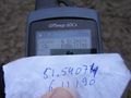
| Sat 14 Mar 2009 in 51,6: 51.5407367, 6.1119046 geohashing.info google osm bing/os kml crox |
Plan
Arvid has a 200km brevet in hilly terrain planned in 2 weeks. But he hadn't done a 200km trip since 2008-11-08. Last week he wanted to do a 200km trip, but after 30kms his waterbag was empty. And his bag very wet. This made him break off the try, and not even report it.
Anyway, weather forecast was wind from south to west. Rain later in the afternoon. I like to have backwind on the way home, so this was a good moment to go south or southwest. South looks like a playground of a school in Gelsenkirchen and southwest in a field next to the Meuse-river. Just back in the Netherlands. The latter was about 110km one way, the other 85km. So lets cross them rivers!
Achievements
- Cycled 227.4km
- Crossed a border, but that wasn't strictly a necessary part of the trip. Although it was definitely shorter.
Expedition
Just before 10:30 I left home. Especially with headwind it's wise to count on 20kph average including stops. I am not all too familiar on the route I took. I only knew the first 40km or so.
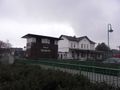
I had a short stop just over the border at Dinxperlo/Süderwick. The border is actually in the street in that village. Yes, it is just one village, it just happens to have a border in it. I'd like a hash again there or close to there sometime, I can document it better then.
After that I just went on. Didn't see a clock anywhere, but I did see my average moving speed was only 22-23kph. Including a stop this can become close. I really had no idea about time nor how far it still was. Until the hashpoint showed up on my GPS, when I came out of the Meuse-Dunes (Maasduinen). It was only 15:30. I was gonna make it!
It became a bit doubtful when the planned road had a warning sign about being a shooting area. And it looked quite muddy too. After the first maintenance the day before I decided not to do stuff like this with this bike anymore! I went on to the next track. That was even muddier. At some point I walked for a bit, cause I couldn't keep enough speed to balance. But this track led me right to the point on the "road" closest to the hash. I was there at 15:45.
There was a grey Opel Corsa on the parking field next to it. Other hashers? Of course not. I went into the muddy field, and took some pictures. I'll show off my real mountainbike cycling shoes here for the first time. They are pearl white and cameras have difficulties with it. Well, at least mine.
At 16:05 I left again, taking a slightly different route to the bridge.
I was home at 20:45. (bit more later)
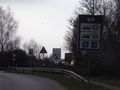
Crossed the border for the first time.
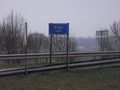
Crossed the Rhine.
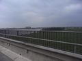
Rhine.
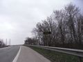
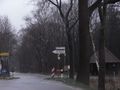
Shooting area. Dont go in when the red flag is there.
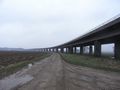
Bridge over the Meuse.
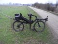
Bike.
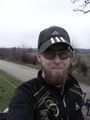
Me.
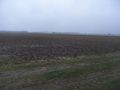
Where the hashpoint is.
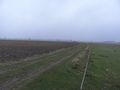
Last bit of "road" I took to the hash.
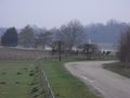
View to the Meuse.
Success!
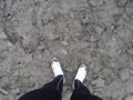
My shoes are too white for my camera. Even with mud.
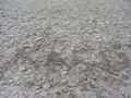
Tag. X is on the hashpoint.
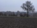
View from the hash to the bike.
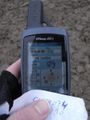
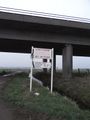
Time and date.
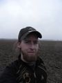
Happy Hasher.
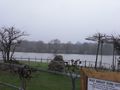
More of the Meuse.
Sign on the bridge.

Ship on the Meuse.
Back into Germany. There was no sign at the other side.
It was close to Airport Weeze.
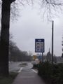
And Weeze has a trainstation too!


