2010-04-08 49 8
| Thu 8 Apr 2010 in 49,8: 49.8194333, 8.6786173 geohashing.info google osm bing/os kml crox |
Location
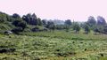
On a meadow in Wilhelmsfeld
Participants
Expedition
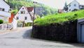
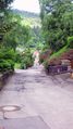
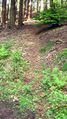
I started by bike from my place in Heidelberg-Kirchheim. The first part of the expedition to the center of Heidelberg was identical with my daily route to university. Not too exciting. I crossed the Neckar river and went on eastwards to Ziegelhausen. When I turned left, away from the river, and the route started to go uphill, I began to realize the I might have underestimated the Odenwald mountains. A few kilometers later, I had to admit to myself that neither my bike nor my body were fit for the steep climb, so I left my bike behind and continued on foot. I went through the woods for a while and soon reached Wilhelmsfeld. The hashpoint was easy to find and access, so I didn't stay there for a long time. I returned to Peterstal, where I had left my bike, and from there went back to Heidelberg.
Tracklog
http://www.everytrail.com/view_trip.php?trip_id=630044
Photos
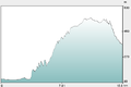
Height profile from OpenRouteService
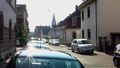
Starting in Heidelberg-Kirchheim
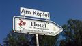
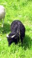
Koepfel's natural habitat
Beginning of the exhausting part

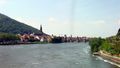
View back to Heidelberg
I decided to leave my bike her...
A decision I didn't regret.
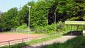
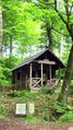
Sports ground in the middle of the woods
OpenStreetMap coverage never ceases to amaze me.
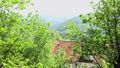
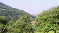
View to Wilhelmsfeld, the hash village
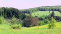
View from hashpoint


Back in Heidelberg


