2014-05-10 52 1
| Sat 10 May 2014 in 52,1: 52.3946230, 1.5524217 geohashing.info google osm bing/os kml crox |
Contents
Location
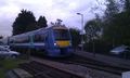
14 metres off a public footpath through a wheat field close to Brampton railway station, Suffolk, UK.
Participants
Expedition
- Arrived. -- Sourcerer (talk) @52.3946,1.5525 15:15, 10 May 2014 (EDT)
This outing should have been really easy being so close to home. I had a printed page with the co-ordinates so of course nothing could go wrong. This was my first outing using the gh.eupeodes.nl calculator. When I entered the co-ordinates they were 140km away. That was easy to fix. Just correct East 0 to East 1 and try again. The new position was still 6km away and only a few metres from my house. Clearly I had misunderstood the screen shot.
It was time to deploy the HTC Droid but of course there was no 3G signal in the valley with the stream. I had to abort the walk and drive to a hill top in range of a 3G mast. The Droid managed to log into the geohashing app and I had the co-ordinates.
This time the circular walk was easy. Follow the stream for a bit. Turn right up the hill. Turn left at the top and notice that there was now a 3G signal so the abort and hill top drive had not been necessary. I got to within 14 metres on the public footpath. The hashpoint was in the wheat field a short way off the path. It was possible to make a small backtrack and use the tractor tracks made during crop spraying. These came right to the hashpoint which was wandering about because of the unstable weather. Success!
Photos

Brampton Railway Station
A Train at Brampton


