2015-05-24 66 25
From Geohashing
Revision as of 06:54, 25 May 2015 by imported>Isopekka ([retro] Hiiii!)
| Sun 24 May 2015 in 66,25: 66.4497151, 25.6774815 geohashing.info google osm bing/os kml crox |
Contents
Location
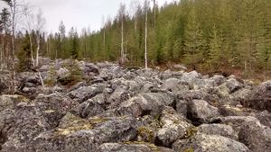
In Rovaniemi, in Korkiavaara.
Participants
Expedition
- Driving total 17 km
- Walking total 1.5 km
- Expedition took 1 h
- Physical effort (1-5): 2
Expedition started about at 1.00 p.m. The hashpoint situated on the hill Korkiavaara.
- Hiiii! -- Isopekka (talk) @66.4947,25.7688 09:54, 25 May 2015 (GMT+03:00)
Photos
Achievements
isopekka earned the Land geohash achievement
|
isopekka earned the Consecutive geohash achievement
|
Geohashing Expeditions and Plans on This Day
Expeditions and Plans
| 2015-05-24 | ||
|---|---|---|
| Portland, Oregon | Shmur | SW Terwiliger Blvd East shoulder across from Tryon Creek State Park |
| Ottawa, Ontario | Jlam | Running track of Rockcliffe Park Public School |
| Pforzheim, Germany | RecentlyChanged | Horb am Neckar |
| Norwich, United Kingdom | Sourcerer | Near the Transport Museum next to a public footpath, Carlton Colville, Suff... |
| Tampere, Finland | Pastori, The Wife, their daughter | In Pirkkala. The point lies in the middle of a motorway. |
| Rovaniemi, Finland | isopekka | In Rovaniemi, in Korkiavaara. |


