2019-12-16 52 12
From Geohashing
Revision as of 09:07, 4 June 2020 by GeorgDerReisende (talk | contribs) (expedition report for Mögelin)
| Mon 16 Dec 2019 in 52,12: 52.5550797, 12.3198754 geohashing.info google osm bing/os kml crox |
Location
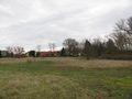
The hash lay on the bivouac place at the river Havel at Mögelin.
Participants
Plans
Travel and walk.
Expedition
It was the usual way. A long travel, a long walk, a long travel.
Tracklog
I created this tracklog with https://www.gpsvisualizer.com/draw/?api=google .
During the Dark Ages I logged all expeditions by contributing to Wikimedia Commons. View all photos of this expedition here.
Photos
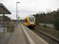
arrived
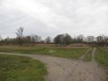
the bivouac place
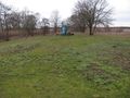
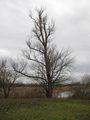
the hash
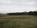
looking north
looking east
looking south
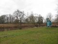
looking west
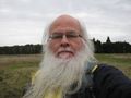
the geohasher


Achievements
GeorgDerReisende earned the Dark Ages achievement
|