2024-01-14 31 34
| Sun 14 Jan 2024 in 31,34: 31.6174995, 34.7457846 geohashing.info google osm bing/os kml crox |
Contents
Location
Plugot Forest outside Kiryat Gat.
Participants
Plans
My foot is still hurting from whatever muscle I pulled in it last week, but if it's any better I'll go. Train to Tel Aviv, train to Kiryat Gat (again! I'm sick of Kiryat Gat points!), bus to Plugot Junction, walk to the point.
Brief concern overnight before the expedition, as the weather forecast had a thunderstorm risk that expired at 2am. I'd have canceled if it was extended but it wasn't.
Expedition
Not only was there no thunderstorm, there was barely any rain. I took the 08:39 train (with Shacharit!) to Tel Aviv, then waited ten minutes for the delayed train to Kiryat Gat. As with my last Sunday geohash, the train was filled to the brim with soldiers returning to the front after a weekend off, which is still a bit depressing because you don't know who won't be coming back.
Because of the delay I had less than a minute to catch the #70 bus that would bring me to Plugot Junction, but I made it. The bus dropped me off in the northeast corner; I crossed to the southwest corner and initially couldn't find the path into the forest. Eventually I realized I needed to head west a bit more, over the roof of a culvert, to reach the start of a path. This would turn out to be a mistake.
There were still a few drops of rain as I set out but they cleared up relatively quickly. The entire path was mud, and my feet were sinking in an inch or so with every step. Squelch squelch squelch. But the first thing I noticed was that the first part of the forest had been cleared out for agricultural land, which I had to carefully go around. Then I saw ahead of me: the river.
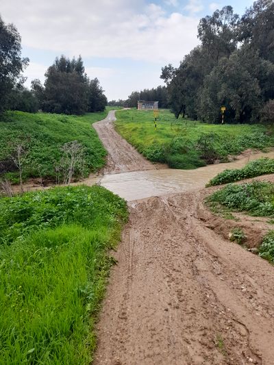
The rainfall meant the river was at its height, and there was a sleek, slippery, massively muddy path straight down into the river and straight up the other side. I should've stayed on the first side of the river.
Well, nothing for it. Carefully, one step at a time, and staying on the grass as much as possible because it was less slippery, I descended towards the river. It's rather amazing that in all my time geohashing I've never had to do this yet... I stepped in.
It was cold, my boots immediately filled up with mud, and as I proceeded through it the water reached my shins but no higher. NBD. Then there was the slippery climb up the other side.
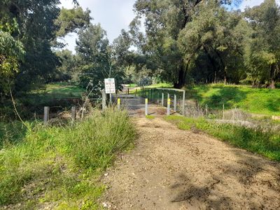
From there it was a relatively straightforward walk down the path, then leaving the path to reach the point. From the point I asked Kipa where the nearest Mincha minyan was (it was before 12:00 but by the time I got back to town it would be time), and then asked Moovit how to get there. It recommended I go back along the same path I came in on, but hook to the left (west) at some point. I wasn't relishing crossing that river again...
Ah. This is a much more convenient path than the one I came in with.
I reached the bus stop and immediately started to gag: there was a massive, overwhelming stench of sewage coming from somewhere, such that I had to breathe through my shirt. Luckily I hadn't eaten lunch yet, and even more luckily it was only a three-minute wait until my bus arrived (though I had resolved to get on whatever bus came first, just to get away from there).
I reached the shul early, had lunch, davened mincha, failed to find a good pharmacy, then got on the next train back to Tel Aviv and then Jerusalem.


