2008-08-23 53 12
| Sat 23 Aug 2008 in 53,12: 53.0212979, 12.7773962 geohashing.info google osm bing/os kml crox |
About
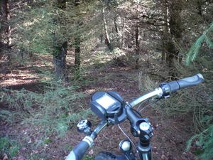
relet took the opportunity of this corner hash to reach the one graticule he left out on his last multihash. After having recently discovered the http://openrouteservice.org website and having hacked some basic route planning into his tangoGPS software, the decision was clear. He would be going all the way by bike, and see if he could follow the stars (cf. photos). They remind him of some retro jump and run games. They'd just have to disappear with a lo-fi pling sound, when you reach them.
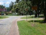
He started out at home at midday, and progressed smoothly in the north-western direction, despite strong winds from the east (10-11 o'clock). As most bus stops in Berlin feature a detailed map of the city, there was little need for navigation. He first powered his GPS in the village of Henningsdorf, where buses are operated by a different company. After leaving the suburbs, it went along the regional roads and through some former farmer villages, whose houses are now are renovated into health centres, tourist attractions, or just large private houses outside the hubbub of the big city.
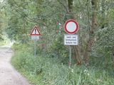
About halfway he had to take the decision whether to follow the openrouteservice suggestion, or whether to follow google maps. "FOLLOW GOOGLE MAPS?!", you will say. Relet did not have the common sense not to, and ended up on some of the worst cobblestone roads he has ever encountered. It started out as a cobblestone road. Then, it became a former cobblestone road, with some remainders of tarmac, broken up by time and weather into a mess of cobble, mud and concrete edges. There were some roads made of concrete slabs, too. After having progressed for a dozen of kilometers along this path of pain, he eventually was informed that in the following the road would be closed due to bad surface conditions. Thank you, Captain Obvious! As you'd expect, the surface did get slightly better after the sign.
After this episode, relet was quite relieved to get back on the regional roads again. They're not always fun to ride when the traffic is dense, but at least they let you reach your goals quickly. He progressed along some beautiful lakes, rivers and small port villages, and it was well worth the trip.
He eventually reached the hash after some 82km of cycling. The satellite images showed a recent plantation of conifers, and it was indeed. Relet was surprised that his GPS showed perfect readings even in this dense canopy of trees. He reached the spot at about 17:15, took some photos, stretched his legs, and cycled back to the town of Neuruppin to jump into the next train back home. He had originally planned to go swimming in the nearby Zermützel lake, but being there he didn't feel like it. There were no ticket inspectors on board (which could have sold him a ticket in the first place), meaning he got a free ride home.
He did not meet any interesting animals this time, except for a common buzzard lying dead by the side of the road - which is an honest pity.
Note: Relet is always amazed at how much you can eat after having yourself exhausted like that.


