2009-09-15 48 9
| Tue 15 Sep 2009 in 48,9: 48.4057106, 9.1249051 geohashing.info google osm bing/os kml crox |
comment3, http://macarenanimo.com/ abilify, http://topologiesalternatives.com/ zithromax, http://tomashernandez.org/ retin a and retinol, http://xdljs.net/ levitra online, http://jacobstickney.com/ levitra, http://aqracing.com/ reductil, http://videosdesuperacion.com/ effects tetracycline, http://conscious-cow.org/ weight loss pill adipex-p, http://localnaturalist.org/ metformin nausea, http://usadigitalwireless.com/ effects side tetracycline, http://gggrub.com/ nexium generic,
Participants
ekorren got as close as 60 metres.
Expedition
I didn't start before around 4 pm this time. There wasn't anything actually new to expect, as I had already visited two other hashpoints around the same village, and came through here on the way to a third one, even only about 200 m from the hash.
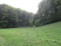
I spent a little bit of time detouring for OSM, passed through the village, and went up on the small gravel road to the Filsenberg mountain range, featured already in March. The printed topographic map and the satellite photo agreed that there should be a forest track parting from the road and leading not too far from the hash. Reality also agreed. With the slight difference, that in reality the meadow the track passed before turning into the forest was a cow paddock, with actual cows in, and fenced.
Of course the fence was probably more to keep the cows in than humans out, but I respect it anyway. So I called that a No Trespassing and turned...
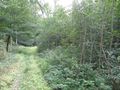
... not away, of course, as there could totally exist a way around, couldn't it? I went along the road until the fence ended, found a place to park my bike, and started fighting my way through the middle of the mountain forest, as the fence did not leave any open space around. After about 150 m of stumbling through luckily rather open forest, and a few metres through a muddy meadow-like place, I reached the track again, this time above of the fenced-off area, and followed it uphill.
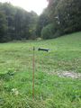
I had expected extremely steep slopes around the hash, even cliffs. I had not expected the kind of densest forest which I now encountered. I got as close as 60 m on the track, give it a few more or less (the GPS had kind of the worst reception possible in "open" landscape), but there was basically no chance to get off the track by more than a few metres into the right direction without using a chainsaw. Which I unfortunately hadn't brought.
MNB it was, then. The third MNB hash in my collection, and the second failed hash on the area of this one village. But since there weren't any achievements in, I didn't really care.
Gallery
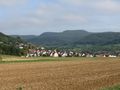
The hash is somewhere over there
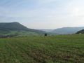
Another Albtrauf view
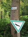
This way up

Don't you dare disturb us grazing!
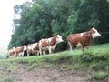
What are they lining up for, anyway?
There is a way through that meadow...
... and it's tempting to open here to actually use it.

Not a way along the fence, either
60 m from the hash is as close as I got
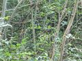
The hash is in there.

Coordinates not reached
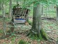
Some of the litter the local hunter left here
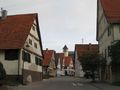
In the old village centre of hash village.


