2010-08-08 -36 174
From Geohashing
Revision as of 04:22, 8 August 2010 by imported>Greenslime (→Achievements)
| Sun 8 Aug 2010 in -36,174: -36.8514438, 174.8988717 geohashing.info google osm bing/os kml crox |
Location
Off the western coastline of Musick Point/Te Waiarohia or Howick golf course
Participants
- Greenslime
- Maximus Adonis
Plans
Satellite imagery suggests that this hash could be accessible at low tide, hence i will ensure that i am on location at 11:00 on sunday to take a look. Research [[1]] shows that the peninsula 'encompasses a narrow band of steep coastal cliffs dominated by mature pohutukawa' hence there may be a quantity of walking up the length of the peninsula involved, probably in mud.
Expedition
Tracklog
Photos
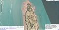
Satellite image of the hash location
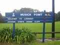
Musick Point
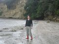
Green at the hash location
View of Rangitoto Island from the hash
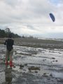
If at all possible, fly a kite!
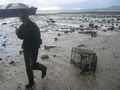
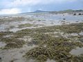
Some geotrash is just too large to extract

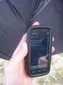
Maximus dealing with GPS versus nature
Proof


Achievements
Greenslime earned the Fly a kite achievement
|
Greenslime earned the Drag-along achievement
|