Location
In the Thuringian forest near Suhl and 100 m above the Autobahn.
Participants
Expedition
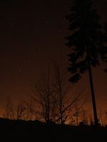
Juja, Manu and Reinhard are spending the weekend in the Thuringian forest and would have passed the hash on their drive from Jena by just some meters. On a map the hash looks close to the Autobahn. In fact, the expressway uses two parallel tunnels and the ground is about 100 meters above. Luckily, there was also a major forest path close to the hash, which would have been utilizable by car. Reinhard, however, stopped the car 400 m to the hashpoint at a parking area. From there they walked on and found out that the hashpoint was 45 m from the path, amid more or less deep snow. After struggling there they took the usual photos (with all the hashcots coming out of warm backpacks) and walked/ran back. While Manu and Juja looked quite frozen, Reinhard thought it would be a good idea to take some photos of the clear night sky using long-term exposure and making the girls shiver even more. After some 20 to 30 seconds exposures Reinhard gave in and stopped the shooting, so they could travel on.
Photos
| Preparing for the short walk.
|
| Coordinates reached after 450 m.
|
| The geohash was suboptimal for low shoes.
|
| A new hasher: Das Schweinchen (on top of a safety car flashlight blinking red).
|
| Juja with Benjy and Frankie mouse, the little Foxi, Janta, Bärchen, Schweinchen, Bobbele, Manu and Reinhard.
|
| The Big Dipper / the Plough / der Große Wagen.
|
|


