2012-04-20
From Geohashing
Revision as of 13:37, 19 April 2012 by imported>AperfectBot (Ook.)
Expedition Archives from April 2012
Thursday 19 April 2012 | Friday 20 April 2012 | Saturday 21 April 2012
See also: Category:Meetup on 2012-04-20
Coordinates
West of -30°: .4368843, .2392987
East of -30°: .5094327, .9102206
Globalhash:
1.697891001451,147.679412299990
Photo Gallery
Expeditions and Plans
| 2012-04-20 | ||
|---|---|---|
| Boise, Idaho | Someone went | Just south of the Boise Airport, off Pleasant Valley Road. |
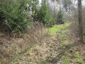
| Pforzheim, Germany | Ekorren | An abandoned forest track between the villages Seebronn, Oberndorf and Wend... |
