2012-10-13
From Geohashing
Revision as of 13:32, 12 October 2012 by imported>AperfectBot (Ook.)
Expedition Archives from October 2012
Friday 12 October 2012 | Saturday 13 October 2012 | Sunday 14 October 2012
See also: Category:Meetup on 2012-10-13
Coordinates
All locations: .6545215, .9964695
Globalhash:
27.813877166641,178.729033121910
Photo Gallery
Expeditions and Plans
| 2012-10-13 | ||
|---|---|---|
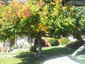
| Tecate, Mexico | LucasBrown | Under a Chinese Lantern tree on Trailridge Drive, Chula Vista |
| Sacramento, California | Someone went | a field off of CR 87B near CR 25, Esparto. |
| Rockford, Illinois | SwensonJ | Farmland east of Darlington, Wisconsin, off County Highway M |
| Portland, Oregon | Jim | Private land (naturally) near North Plains, Oregon |
| München, Germany | Jcbck | at the side of a dirt track east of Pfeffenhausen |
| Würzburg, Germany | Danatar | in an empty field near Giebelstadt. Country: Germany; state: Bayern (Bavar... |
| Southampton, United Kingdom | Jand, Jand's Dad | In an area of deep dark swamp near Corfe Castle in the Isle of Purbeck. |

