2015-03-01 49 19
| Sun 1 Mar 2015 in 49,19: 49.9960394, 19.8743223 geohashing.info google osm bing/os kml crox |
Contents
Location
In a field near a ditch just off Działowskiego street in the Kobierzyn district of Kraków, Poland.
Participants
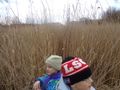
Malgond with kids.
Plans
- I don't have a GPS, but there are some reference points nearby, so I'll try to use them. I've made some measurements on Google Maps.
- Distance from a tree growing at the ditch, along and across:
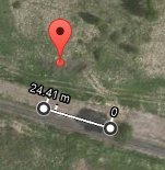
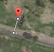
- In case the tree isn't standing there any more - distance from ditch's bend:
- Distance from a tree growing at the ditch, along and across:
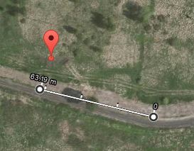
- I plan to earn the Juggernaut achievement. Here's a straight line from the nearest section of paved road close to my home:


Expedition
We've reached the spot, albeit not in so straight a line - boggy terrain.
Over the ditch
We have started on a street near our home. I have checked the compass and off we went through the field. The group of trees located just south of our 260° track could be clearly seen so I just headed towards what looked like the rightmost one. It turned out that there was still another, smaller tree to the right so we went to the right of it. Thorns and dense patches of high dry cane weren't going to stop us! Finally we've arrived at the ditch crossing our track. I had originally indended to jump over it, but it happened to be much wider then it used to be closer to home, so I went with the backup plan of going a little to the south of our intended track along the ditch and crossing it by the nearby bridge.
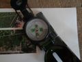
Checking our heading. It's 260°
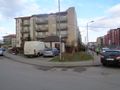
Starting point.
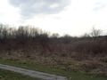
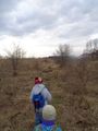
General direction we're heading at.
Heading 260: to the right of this tree!
Through hawthorn bushes.
Crossing a footpath on our track.
Err, actually our track goes to the right of the smaller tree.
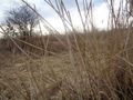
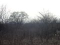
Forests and glades of cane. Almost at the tree.
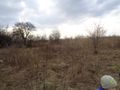
First signs of spring.
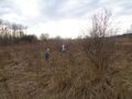
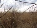
Looking back through a cane forest.
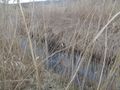
The ditch is too wide to jump over it.
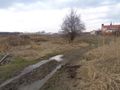
Crossing the ditch by a bridge. Local church in the background.


Wild boars' home
After crossing the ditch we went a short distance along the dirt road being an extension of Małysiaka street that runs along the church and looked back towards our home to re-establish ourselves on our track using the compass. Then we've turned towards our destination. The terrain was rising a little and obscuring the view with a featureless field of dry grass and low bushes. I have checked the compass again to get the general direction and we have entered an abandone construction site that lies across the street from the church. Two disgressions are due.
- The site has been an empty field once. Several years ago it had been fenced, levelled, bushes uprooted and a row of legally required signs had been posted saying that a row of homes is going to be built there. Some excavations had started, then nothing happened for a long time. Today, as we happened to see, there's no trace of construction signs, the fence is in a sorry state and excavations are filled. The mysterious lighter-coloured rectangles that can bee seen Google Maps there (see my plan) are the traces of the former excavations.


To be continued...
Note: I've managed to upload all the photos with descriptions, look there if you're impatient.
Achievements
User:Malgond earned the Land geohash achievement
|
User:Malgond earned the Walk geohash Achievement
|
User:Malgond earned the No Batteries Geohash Achievement
|