2015-06-29
From Geohashing
Revision as of 13:40, 26 June 2015 by imported>AperfectBot (Ook.)
Expedition Archives from June 2015
Sunday 28 June 2015 | Monday 29 June 2015 | Tuesday 30 June 2015
See also: Category:Meetup on 2015-06-29
Coordinates
West of -30°: .8849634, .5472295
East of -30°: .9736694, .8670989
Globalhash:
85.260487726321,132.155594738450
Photo Gallery
Expeditions and Plans
| 2015-06-29 | ||
|---|---|---|
| London East, United Kingdom | Sourcerer | 1) Very close to a public footpath, Nayland, Suffolk, UK. |
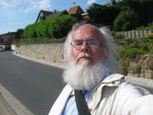
| Kassel, Germany | GeorgDerReisende | The hash lies in the main street of Alfeld-Hörsum. |
| Cambridge, United Kingdom | Sourcerer | 2) On the mud flats north of Wells Next the Sea, Norfolk, UK. |
