Location
Within natural preserve Windknollen near Jena, Thuringia, Germany.
Participants
Expedition
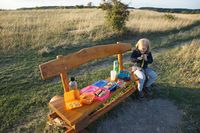
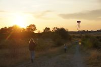
What a beautiful chance for a geohashing family picnic in the evening. We parked the car at the upper end of Rautal, close to Closewitz and walked about 1.4 km to the hashpoint which was only few meters from a popular path which also Manu and Reinhard have been walking, cycling and skiing on before. A bench was only 95 m from the hashpoint and still illuminated from the evening sun and that's why chosen for the delicious picnic Manu and Bergie have prepared beforehand. Before the sun set, the children flew their kite and we all walked back to the car.
Tracklog
Strava activity (just the hike)
Photos
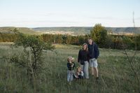
| At the hashpoint (Jena in the back).
|
|
