2015-10-17 63 28
| Sat 17 Oct 2015 in 63,28: 63.8748105, 28.4796840 geohashing.info google osm bing/os kml crox |
Location
In Maanselkä, Valtimo. The point lies in a forest near the border of Valtimo and Sotkamo.
Participants
Expedition
Tilley and his family were visiting Pastori and The Wife for a week of autumn holiday.
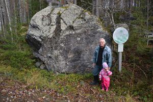
After roaming in the Pastori's piece of land and the nearby fields and forests for the whole week, all of us were ready for an expedition little further. Today's hashpoint was 15 km away, and that was our main target. Near the hashpoint, about one kilometer away, was also a historical place, an ancient border stone that has probably first marked the border between Sweden and Russia in 1595, as agreed in [the Treaty of Täyssinä]. There was also a geocache near the border stone.
First we drove to the border stone, because our team's youngest member wanted there first. That was probably because she wanted to exchange some toys in the geocache. At the site we found the geocache easily, and luckily there were some toys also. After admiring the surroundings and the view from the top of the stone, we quickly (before Tilley's daughter fell asleep) drove to the hash-site.
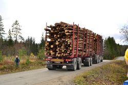
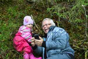
After letting a huge timber truck pass, we entered the forest clearing. There was about 250 meters to the point. The going was relatively easy, even our team's youngest member managed to walk by herself all the way to the hashpoint. About 20 meters before the point, the forest changed into a very thick spruce-thicket. So not much of a view from the actual point. Using two devices, we quickly pinpointed the point with about a 2 meters accuracy.
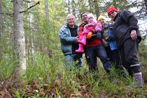
Getting a group photo was a bit trickier because of lack of tripod, but after toppling the camera once in mid-self-timer-count, we managed to get a decent picture. We quickly retreated back to the clearing, where also the Sun started to lighten our trip. After taking a few posing pictures in good light, we went back to the car and drove back to Pastori's place to heat up the sauna. You see, in Saturdays at 16 o'clock Finnish people are in the sauna, not in any other kind of meetup.
Overall this was a very nice autumn hash-trip!
Additional photos
Achievements
Tilley, Pastori & co earned the Land geohash achievement
|


