2019-02-03 54 13
| Sun 3 Feb 2019 in 54,13: 54.1288409, 13.2398862 geohashing.info google osm bing/os kml crox |
Location
In a field south-east of Horst (MV, Deutschland)
Participants
Plans
Today's plan is to go out some time in the morning, grab my bike to the hash, and then go find the geocache which made me discover geohashing. (And ride back home, but that's not today's main goal)
Expedition
It has been a while since my last geohash. I tried to be aware of hashes while I was back home, but there was no luck. And it has not been until today that I had a feasible hash to search for (minding that I go by bike and its getting colder day by day). But what made it more special is that today's hash fell, more or less, near the mystery geocache that made me discover geohashing. So it was a nice opportunity.
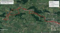
I grabbed my bike at.. I think it was already 11:00 (I am not an early worm as you can see), and started my way. The first 1-2 hours where paths that I already knew. But then I started to discover new areas, including the hash area. As usual, the hash fell in a field (graticule 54 13 is 78% water and in second place 10% fields). I walked on the margin as long as I could and the the final 60 meters approach to reach the exact point of the hash. It is bad luck enough that the battery of my GPS died just on the hash, but I had a fresh batteries on my backpack and a quick change saved the tracklog ;)
Well, first goal accomplished. Now for the geocache.
Right after that I arrived in Horst. I stopped there for a while to visit the church. So little villages but with big churches. And all of them similar but unique in their own way. It kind of what makes Mecklenburg-Vorpommern distinct.
After Horst I arrived at Wüst-Eldena. On this village I crossed the river Ryck for the second time. This river, is the same that flows to Greifswald. It's the most west I have been on the Ryck. And right here, after crossing the autobahn, is where the mystery cache is hidd--- ups. spoiler! Maybe I must censor this part of the expedition.
Nothing much to censor, actually ;) Cache very well hidden but found, and after having something to eat it was time to go back. I almost took the same path I took to get here. So nothing much new. Rode again near the field-hash, and a few hours later, again home. Tired, with 58km on my back, full of mud, but satisfied on fulfilling today's goals.
I hope I can go hashing again soon!
Tracklog
Photos
Achievements
SastRe.O earned the Land geohash achievement
|
SastRe.O with Winterbuche earned the Bicycle geohash achievement
|
Other Geohashing Expeditions and Plans on This Day
Expeditions and Plans
| 2019-02-03 | ||
|---|---|---|
| McMinnville, Oregon | Michael5000 | On Briedwell Road in the farmland northwest of Amity. |
| Frankfurt am Main, Germany | Mampfred, QuarterCacher, EmmJay | In the woods not far from the "Hubertushütte". |
| Stralsund, Germany | SastRe.O | In a field south-east of Horst (MV, Deutschland) |


