2024-06-29 49 8
| Sat 29 Jun 2024 in 49,8: 49.9030150, 8.6133894 geohashing.info google osm bing/os kml crox |
Location
In a forest area, about 60 meters away from the closest path (according to OpenStreetMap), in Darmstadt-Dieburg county, Hesse, Germany. The closest built-up area is the commercial park of Weiterstadt in south direction, over the Rhein-Main railway.
This day’s weather: sunny with a few clouds, warm, getting really hot and sticky in the course of the day
Participants
- Green guy! (talk)
- Green guy!’s mother (no consent to publish photos of her)
- Green guy!’s father (no consent to publish photos of him)
Plans
- Drive near the geohash before it gets too hot and sticky! (likely around 11 am)
- Park our car next to the Wasserwerk (water works)
- Go on a forest walk to visit the hashpoint
- Drive back home
Expedition
As planned, before it got too hot, a few minutes after 11 am, my parents and I drove to the parking lot next to the Wasserwerk (water works). After parking our car, we crossed the secondary road L3113 and looked for a way to reach the coordinates. We tried the path at the small residential area, but it turned out to be driveway to private property with a locked gate to prevent trespassing.
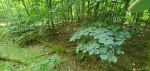
With that knowledge, we walked back south and entered the forest from the roadside to then intricately make our way through the thicket. It took a while to reach the coordinates, but we ultimately made it there and also managed to return safely to the roadside (except for a few ticks and minor scratches).
Back at our car, we decided to walk a little more by going south from the Wasserwerk and coming back.
Overall, it was a really adventurous expedition, according to my standard at this time. My parents stated that they never walked through a forest thicket like this one before and that I would be keeping them young (by taking them with me on such trips).
Back at home, my mom checked everyone for ticks – she found two on my body which were trivial to remove (as they didn’t have much time). As this expedition worked up a sweat on all of us and because the weather is hot, we took refreshing showers.
Tracklog: Walking to the hashpoint
- I started the tracklog in the car near Weiterstadt and stopped it when coming back to the car after the expedition.
- GPS accuracy: medium
- Markers show all locations where I took photos – a few of them are taken for OpenStreetMap surveying.
Pictures
Achievements
First-time
I earned these for the first time from this geohash.
Green guy! (talk) earned the Two to the N achievement
|
Green guy! (talk) earned the Thicket Ticks Achievement
|
Recurring
I already earned these from an earlier geohash, but fulfilled the conditions again on this one.
Green guy! (talk) earned the Land geohash achievement
|


