2019-10-08 51 13
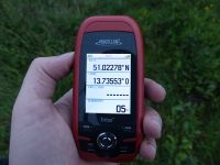
| Tue 8 Oct 2019 in Dresden: 51.0227874, 13.7355734 geohashing.info google osm bing/os kml crox |
Location
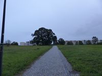
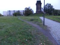
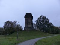
Today's location is in a meadow at Dresden-Räcknitz, between the memorial to General Moreau and the Bismarck Column.
Country: Germany; state: Sachsen (Saxony, EU:DE:SN); district: Dresden; Stadtbezirk: Plauen; Stadtteil: Räcknitz/Zschertnitz
Weather: clouded
Expedition
Danatar
The hashpoint was not too far from home and promised to have interesting sights next to it, so I decided to cycle there even though the weather was rainy. After work there was only very light raindrops falling so I started by cycling through the Großer Garten, then through some smaller streets and paths up the slight incline of the Räcknitzhöhe hill.
When I was cycling through Räcknitzer Weg lane I saw a person fall down in front of a car at the next intersection. I sprinted the last 50-80 meters while the car pulled back a bit and another passerby also hurried to help. It turned out that the car driver came from the small street straight ahead and had been allowed by some other cars to cross the intersection first. At the same time, an old woman on foot was walking along Räcknitzhöhe street and crossing Räcknitzer Weg on her way to the supermarket, having the right of way but also not seeing the car because she had her hood drawn down against the rain. So the car very slowly crashed against the pedestrian, pushing her to the ground and (according to the other helper) coming to a stop on her foot. The old woman was bleeding from a laceration on her eyebrow and had pain in her shoulder and foot, but she was completely concious. The driver was very agitated and reproachful. A jogger called an ambulance while the other helper and I looked after the victim, stopping the bleeding with handkerchiefs. The ambulance took rather long to arrive. A short while after people from Dresden University's "cause of accident research team" arrived to take pictures of the car and the area. It took even longer for the police to arrive because they had only been alarmed by the paramedics when they found out there was an injured person (I don't know what the jogger said when he called the ambulance). The other helper and I gave our names to the police and told them what we saw, then we were allowed to go.
After this unexpected interruption of 50 minutes I cycled along Räcknitzhöhe street until I was near the hashpoint. The spot was easy to find and I took some pictures. Then I took a look at the Bismarck Column (German wikipedia page for the Dresden-Räcknitz one here). As with the other Bismarck Towers and Columns it was built to honor Otto von Bismarck.
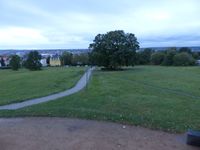
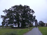
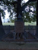
The other interesting thing near the hashpoint is the memorial (German wikipedia here) to Jean-Victor Moreau, a French general who was a rival to Napoleon. On 1813-08-27 (7 weeks before the Battle of the Nations at Leipzig) the Battle of Dresden took place at the hashpoint (and in the surrounding countryside, you need lots of space for 300 000 soldiers), Moreau fighting at the side of the Russian Tsar Alexander I. against Napoleon. According to the German wikipedia page, a cannonball destroyed both of Moreau's legs, leading to his death a few days later. Later, the neoclassic memorial was built at the site of his injuring and the legs were buried there. The three big oak trees around the memorial were planted in 1814.
Then I cycled home.
Danatar certifies that General Jean-Victor Moreau's legs almost (by 45m) earned the Coffin Potato Achievement
|
Danatar earned the Dark Ages achievement
|
|
tracklog
