2008-06-29 53 9
From Geohashing
Revision as of 16:18, 29 June 2008 by imported>Hermann (New page: {{meetup graticule | map=<map lat="53" lon="9" date="2008-06-29" /> | lat=53 | lon=9 | date=2008-06-29 }} ==About== The coordinates of this geohash are <pre> 53.608045962575794, 9.5754466...)
| Sun 29 Jun 2008 in 53,9: 53.6080460, 9.5754466 geohashing.info google osm bing/os kml crox |
About
The coordinates of this geohash are
53.608045962575794, 9.575446623441385
It's in the middle of the river Elbe.
Expedition
Hermann was there:
detailed information will follow
Technical details:
- Trip: 26.87 km
- Time: 1:42:33 h
- Mean speed: 15.72 km/h
- Pictures
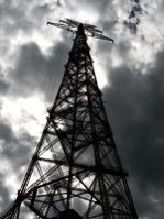
A freaking huge pylon
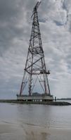
It doesn't grow smaller if you step back
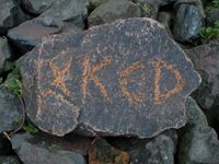
A marker

Proof of location
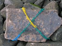
A more waterproof marker
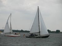
Excuse me, can you take me to 53.6080459, 9.5754466?


